| P number: | P002013 |
|---|---|
| Old photograph number: | C00473 |
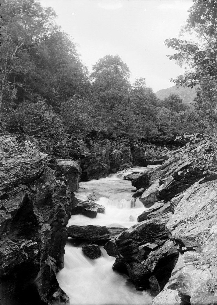
| Caption: | Pass of Glen Lyon, 3.2 km. or so west of Fortingall, 15.2 km. west of Aberfeldy, Perthshire. Rock gorge and pot-holes cut in Dalradian Ben Lawers Schist, pelites and calcareous pelite bands. |
| Description: | Pass of Glen Lyon, 3.2 km. or so west of Fortingall, 15.2 km. west of Aberfeldy, Perthshire. Rock gorge and pot-holes cut in Dalradian Ben Lawers Schist, pelites and calcareous pelite bands. The deep pools are formed by the process of corrasion, the wearing away of the sides and river bottom with the aid of boulders and pebbles that are being transported by the river. What starts out as depressions in the rocky channel soon capture pebbles etc. which swirl round in the eddies and so deepen the river bed to form deep pools or pot-holes. As the pebbles are worn down, new ones enter to continue the process. |
| Date taken: | Wed Jan 01 00:00:00 GMT 1902 |
| Photographer: | Lunn, R. |
| Copyright statement: | Crown |
| Acknowledgment: | This image was digitized with grant-in-aid from SCRAN the Scottish Cultural Resources Access Network |
| X longitude/easting: | 270500 |
| Y latitude/northing: | 747500 |
| Coordinate reference system, ESPG code: | 27700 (OSGB 1936 / British National Grid) |
| Orientation: | Portrait |
| Size: | 254.37 KB; 712 x 1001 pixels; 60 x 85 mm (print at 300 DPI); 188 x 265 mm (screen at 96 DPI); |
| Average Rating: | Not yet rated |
| Categories: | Unsorted Images, Geoscience subjects/ Landforms, river/ Waterfalls and pot-holes |
Loading...
Loading...
Reviews
There is currently no feedback