| P number: | P002005 |
|---|---|
| Old photograph number: | C00436 |
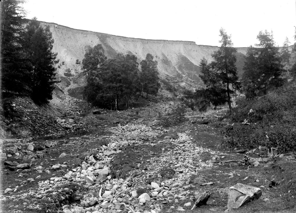
| Caption: | Burn a little north of Tynateid, 1.8 km. south-south-east of Killiecrankie Station, Perthshire. A section in deep boulder clay approximately 100 feet deep in a misfit stream valley. |
| Description: | Burn a little north of Tynateid, 1.8 km. south-south-east of Killiecrankie Station, Perthshire. A section in deep boulder clay approximately 100 feet deep in a misfit stream valley. This is a well-known section of boulder clay east of Tynateid that was described by Dr. T.F. Jamieson in his paper on the Drift of the north of Scotland. It shows the great depth to which boulder clay was deposited as ground moraine by the retreating ice sheets. There is a faintly-marked stratification dipping gently to the westward. |
| Date taken: | Wed Jan 01 00:00:00 GMT 1902 |
| Photographer: | Lunn, R. |
| Copyright statement: | Crown |
| Acknowledgment: | This image was digitized with grant-in-aid from SCRAN the Scottish Cultural Resources Access Network |
| X longitude/easting: | 291600 |
| Y latitude/northing: | 760900 |
| Coordinate reference system, ESPG code: | 27700 (OSGB 1936 / British National Grid) |
| Orientation: | Landscape |
| Size: | 289.74 KB; 1000 x 721 pixels; 85 x 61 mm (print at 300 DPI); 265 x 191 mm (screen at 96 DPI); |
| Average Rating: | Not yet rated |
| Categories: | Unsorted Images, Geoscience subjects/ Landforms, glaciation/ Glacial deposits, boulder clay, sand, gravel |
Loading...
Loading...
Reviews
There is currently no feedback