| P number: | P002001 |
|---|---|
| Old photograph number: | C00418 |
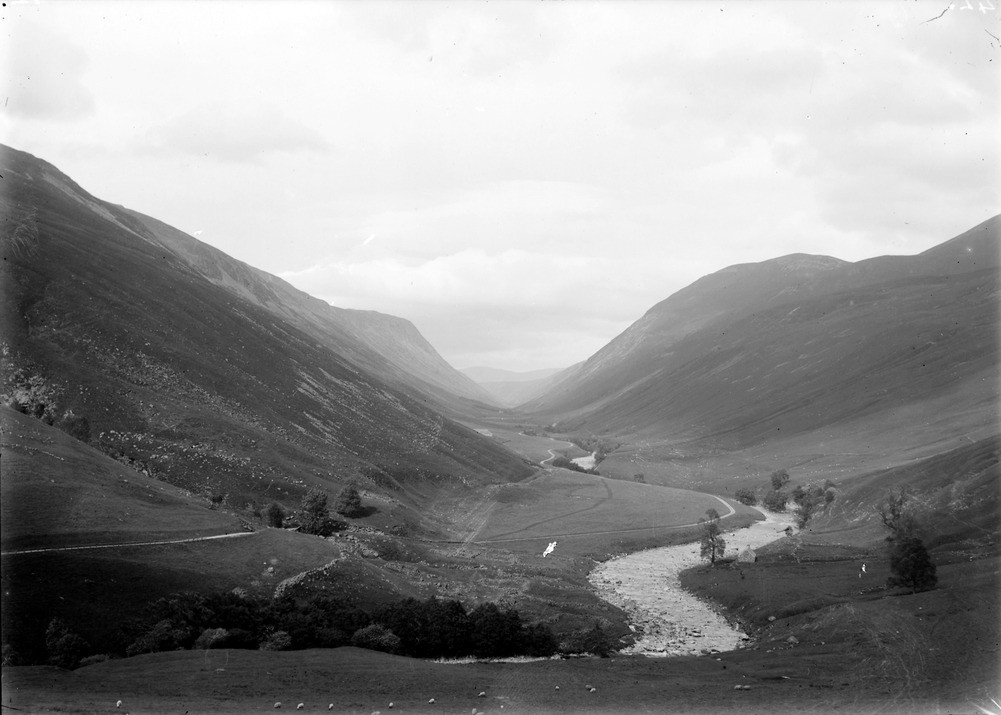
| Caption: | Glen Tilt, from hillside east of Marble Lodge, looking north, Perthshire. Typical V-shaped valley along shatter belt. |
| Description: | Glen Tilt, from hillside east of Marble Lodge, looking north, Perthshire. Typical V-shaped valley along shatter belt. The valley has moraines on the middle slopes, low alluvial terraces and a river that is now being incised. It was originally V-shaped, but the talus and drift on the lower slopes make it appear more U-shaped. The valley follows the line of the Loch Tay Fault, one of a series of brittle north-east - south-west trending faults formed after the end of the Caledonian Orogeny. It is thought that this fault could have formed on the limb of late ductile folds during the final stages of this Orogeny, it is in close proximity to such a fold called the Boundary Slide. The valley never contained an active scouring glacier, hence the lack of a glacial U-shaped valley. The ice sheets at the time travelled right over the valley at an angle, the valley probably being filled with fairly static ice. |
| Date taken: | Wed Jan 01 00:00:00 GMT 1902 |
| Photographer: | Lunn, R. |
| Copyright statement: | Crown |
| Acknowledgment: | This image was digitized with grant-in-aid from SCRAN the Scottish Cultural Resources Access Network |
| X longitude/easting: | 290200 |
| Y latitude/northing: | 771700 |
| Coordinate reference system, ESPG code: | 27700 (OSGB 1936 / British National Grid) |
| Orientation: | Landscape |
| Size: | 138.04 KB; 1001 x 715 pixels; 85 x 61 mm (print at 300 DPI); 265 x 189 mm (screen at 96 DPI); |
| Average Rating: | Not yet rated |
| Categories: | Unsorted Images, Geoscience subjects/ Landforms, glaciation/ Glaciated valleys |
Loading...
Loading...
Reviews
There is currently no feedback