| P number: | P001999 |
|---|---|
| Old photograph number: | C00407 |
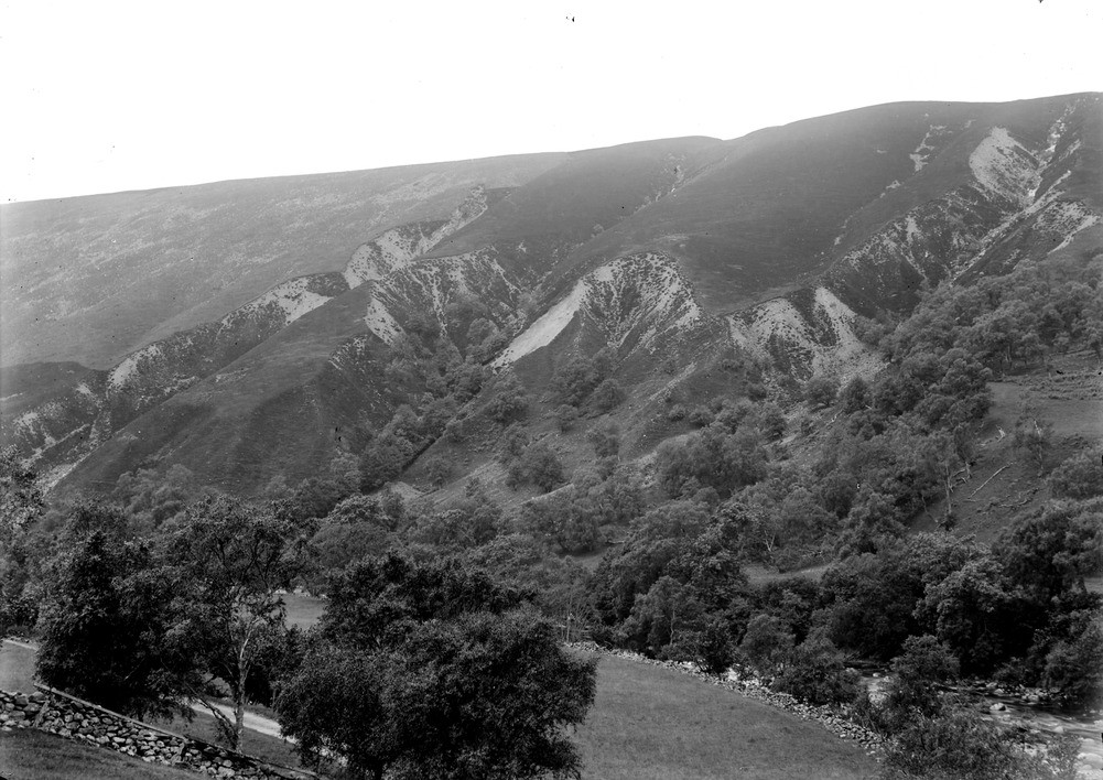
| Caption: | South-west of Marble Lodge, Glen Tilt, 6.4 km. north of Blair Atholl, Perthshire. Gully erosion in a glacial moraine barrier. |
| Description: | South-west of Marble Lodge, Glen Tilt, 6.4 km. north of Blair Atholl, Perthshire. Gully erosion in a glacial moraine barrier. Glacial moraine deposits form a barrier across the Tilt Valley and have subsequently been cut through by a stream which has also been partially deflected by it. Mountain stream channels are eroding through the drift to form steep V-shaped gullies the sides of which are sometimes bare where there is active erosion. Note the centre stream cutting back up the centre of a spur, and the spur to the left which has just been breached from either side. Rapid erosion on the now un-vegetated breach will, in time, cause the top and the bottom of the spur to become separated. |
| Date taken: | Wed Jan 01 00:00:00 GMT 1902 |
| Photographer: | Lunn, R. |
| Copyright statement: | Crown |
| Acknowledgment: | This image was digitized with grant-in-aid from SCRAN the Scottish Cultural Resources Access Network |
| X longitude/easting: | 289000 |
| Y latitude/northing: | 771000 |
| Coordinate reference system, ESPG code: | 27700 (OSGB 1936 / British National Grid) |
| Orientation: | Landscape |
| Size: | 221.60 KB; 1001 x 708 pixels; 85 x 60 mm (print at 300 DPI); 265 x 187 mm (screen at 96 DPI); |
| Average Rating: | Not yet rated |
| Categories: | Unsorted Images, Geoscience subjects/ Landforms, glaciation/ Moraines, Geoscience subjects/ Landforms, river/ River capture and diverted drainage |
Loading...
Loading...
Reviews
There is currently no feedback