| P number: | P001998 |
|---|---|
| Old photograph number: | C00406 |
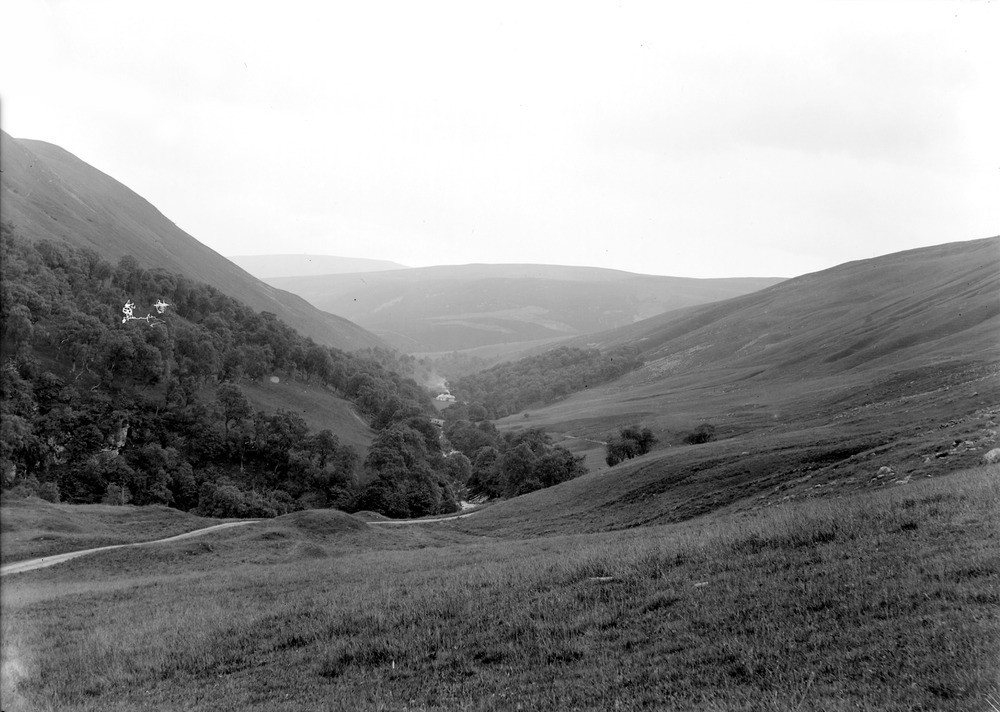
| Caption: | South-west of Marble Lodge, Glen Tilt, 6.4 km. north of Blair Atholl, Perthshire. Glacial moraine deposits formed a barrier across the Tilt Valley which has been subsequently cut through by a stream which has also been partially deflected by it. |
| Description: | South-west of Marble Lodge, Glen Tilt, 6.4 km. north of Blair Atholl, Perthshire. Glacial moraine deposits formed a barrier across the Tilt Valley which has been subsequently cut through by a stream which has also been partially deflected by it. Dalradian metasedimentary rocks have been cut by the major brittle north-east - south-west trending Loch Tay Fault formed after the end of the Caledonian Orogeny. The fault has acted as large line of weakness that has been exploited during a long history of erosion. |
| Date taken: | Wed Jan 01 00:00:00 GMT 1902 |
| Photographer: | Lunn, R. |
| Copyright statement: | Crown |
| Acknowledgment: | This image was digitized with grant-in-aid from SCRAN the Scottish Cultural Resources Access Network |
| X longitude/easting: | 289000 |
| Y latitude/northing: | 771000 |
| Coordinate reference system, ESPG code: | 27700 (OSGB 1936 / British National Grid) |
| Orientation: | Landscape |
| Size: | 172.99 KB; 1000 x 712 pixels; 85 x 60 mm (print at 300 DPI); 265 x 188 mm (screen at 96 DPI); |
| Average Rating: | Not yet rated |
| Categories: | Unsorted Images, Geoscience subjects/ Landforms, glaciation/ Moraines, Geoscience subjects/ Landforms, river/ River capture and diverted drainage |
Loading...
Loading...
Reviews
There is currently no feedback