| P number: | P001997 |
|---|---|
| Old photograph number: | C00405 |
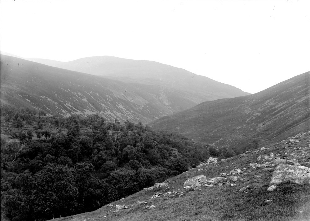
| Caption: | Glen Tilt, south-west of Marble Lodge, four miles north-west of Blair Atholl, Perthshire. A glacial moraine barrier extends across the Tilt Valley, this has been cut through by a stream that has been partly deflected by it. |
| Description: | Glen Tilt, south-west of Marble Lodge, four miles north-west of Blair Atholl, Perthshire. A glacial moraine barrier extends across the Tilt Valley, this has been cut through by a stream that has been partly deflected by it. The valley follows the line of the Loch Tay Fault, one of a series of major brittle north-east - south-west trending faults formed after the end of the Caledonian Orogeny. It is thought that this fault could have formed on the limb of late ductile folds during the final stages of this Orogeny, it is in close proximity to such a fold called the Boundary Slide. The fault has acted as large line of weakness that has been exploited during a long history of erosion. |
| Date taken: | Wed Jan 01 00:00:00 GMT 1902 |
| Photographer: | Lunn, R. |
| Copyright statement: | Crown |
| Acknowledgment: | This image was digitized with grant-in-aid from SCRAN the Scottish Cultural Resources Access Network |
| X longitude/easting: | 289000 |
| Y latitude/northing: | 771000 |
| Coordinate reference system, ESPG code: | 27700 (OSGB 1936 / British National Grid) |
| Orientation: | Landscape |
| Size: | 178.03 KB; 1000 x 714 pixels; 85 x 60 mm (print at 300 DPI); 265 x 189 mm (screen at 96 DPI); |
| Average Rating: | Not yet rated |
| Categories: | Unsorted Images, Geoscience subjects/ Landforms, glaciation/ Moraines, Geoscience subjects/ Landforms, river/ River capture and diverted drainage |
Loading...
Loading...
Reviews
There is currently no feedback