| P number: | P001996 |
|---|---|
| Old photograph number: | C00403 |
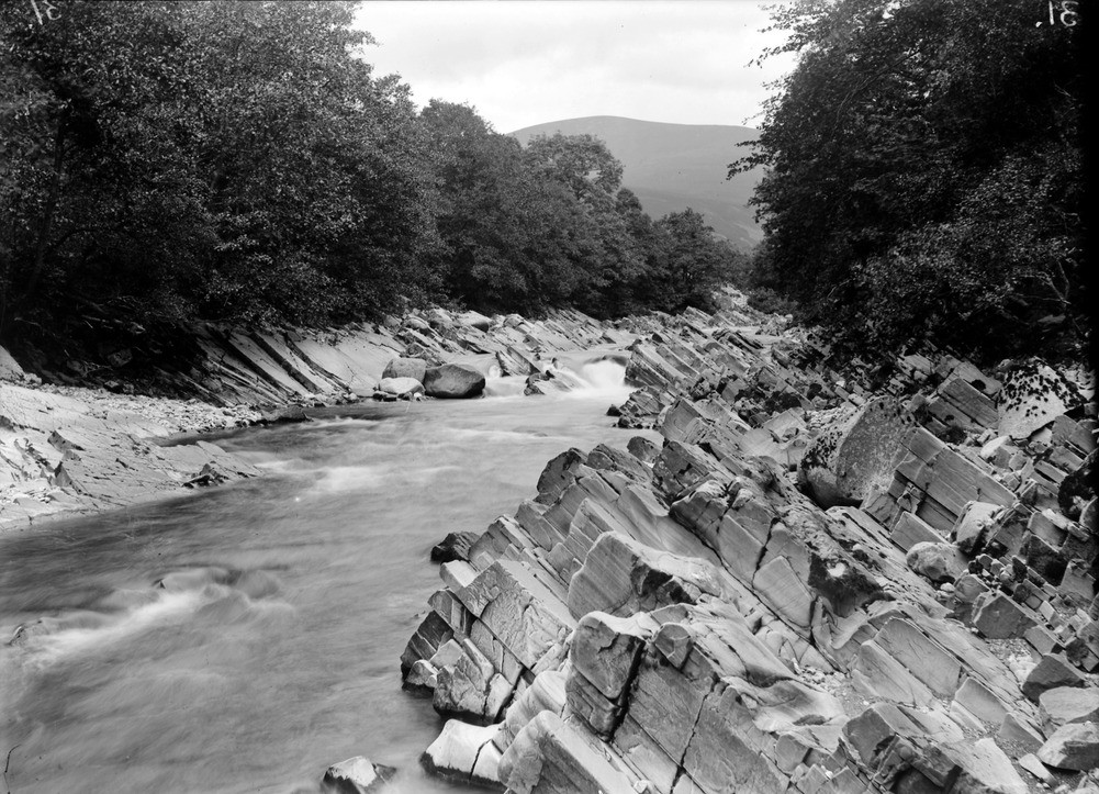
| Caption: | Gilberts Bridge', Glen Tilt, 4.8 km. north of Blair Atholl, Perthshire. Looking north. Dalradian Grampian Group flaggy metasedimentary rocks. |
| Description: | Gilberts Bridge', Glen Tilt, 4.8 km. north of Blair Atholl, Perthshire. Looking north. Dalradian Grampian Group flaggy metasedimentary rocks. Interbedded psammites and micaceous psammites with calc-silicate pods. The flaggy nature is due to the nearby influence of the major tectonic structure called the Boundary Slide. This separates the Southern Grampians Complex from the structurally underlying Central Grampians Complex. |
| Date taken: | Wed Jan 01 00:00:00 GMT 1902 |
| Photographer: | Lunn, R. |
| Copyright statement: | Crown |
| Acknowledgment: | This image was digitized with grant-in-aid from SCRAN the Scottish Cultural Resources Access Network |
| X longitude/easting: | 288200 |
| Y latitude/northing: | 770200 |
| Coordinate reference system, ESPG code: | 27700 (OSGB 1936 / British National Grid) |
| Orientation: | Landscape |
| Size: | 273.60 KB; 1001 x 723 pixels; 85 x 61 mm (print at 300 DPI); 265 x 191 mm (screen at 96 DPI); |
| Average Rating: | Not yet rated |
| Categories: | Unsorted Images, Geoscience subjects/ Structural features/ Folding |
Loading...
Loading...
Reviews
There is currently no feedback