| P number: | P001987 |
|---|---|
| Old photograph number: | C00342 |
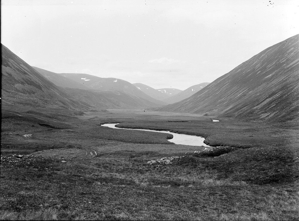
| Caption: | Glen Ey, 5.6 km. south-south-east of Inverey, 9.6 km. south-west of Braemar, looking south-south-west, Aberdeenshire. A silted-up former moraine-dammed lake. |
| Description: | Glen Ey, 5.6 km. south-south-east of Inverey, 9.6 km. south-west of Braemar, looking south-south-west, Aberdeenshire. A silted-up former moraine-dammed lake. Site of moraine-dammed lake (now silted-up) in a 'strike valley', carved out of Dalradian limestone and dark schist, flanked by quartzites. Portion of barrier moraine forms foreground. Note the very flat valley floor and the meanders in the Ey Burn. |
| Date taken: | Sat Jan 01 00:00:00 GMT 1898 |
| Photographer: | Lunn, R. |
| Copyright statement: | Crown |
| Acknowledgment: | This image was digitized with grant-in-aid from SCRAN the Scottish Cultural Resources Access Network |
| X longitude/easting: | 309300 |
| Y latitude/northing: | 783500 |
| Coordinate reference system, ESPG code: | 27700 (OSGB 1936 / British National Grid) |
| Orientation: | Landscape |
| Size: | 212.78 KB; 1000 x 737 pixels; 85 x 62 mm (print at 300 DPI); 265 x 195 mm (screen at 96 DPI); |
| Average Rating: | Not yet rated |
| Categories: | Unsorted Images, Geoscience subjects/ Landforms, glaciation/ Moraines |
Loading...
Loading...
Reviews
There is currently no feedback