| P number: | P001983 |
|---|---|
| Old photograph number: | C00117 |
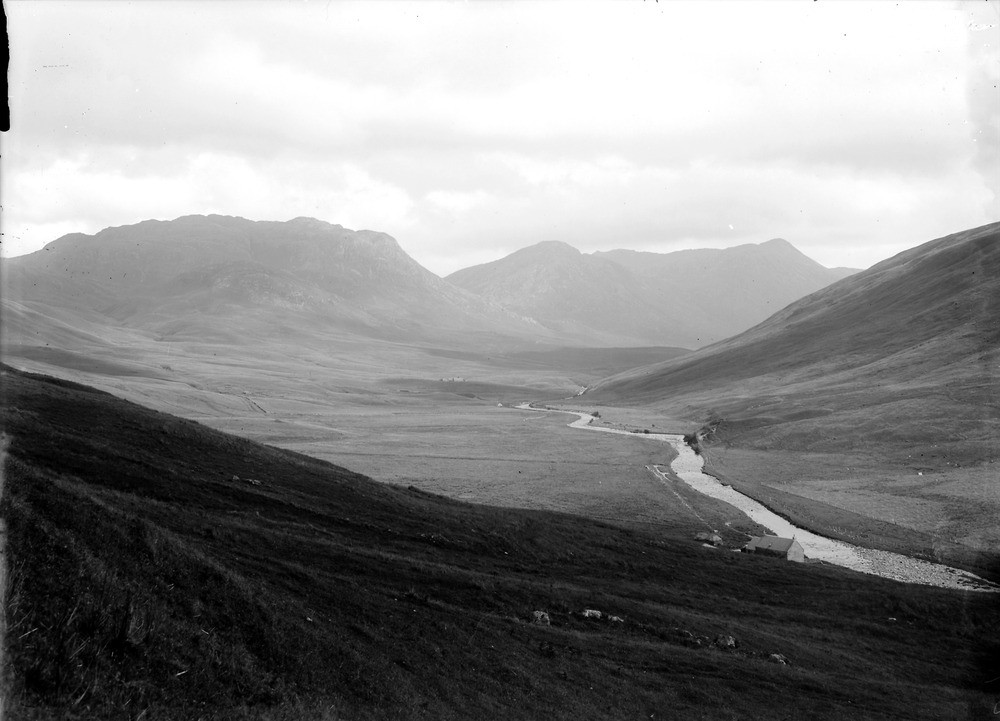
| Caption: | View looking east-south-east up the Glenmore River, from near Achadhachuirn, about 6.4 km. east-north-east of Glenelg, Inverness-shire. |
| Description: | The complex covers an area of 18 square km. and consists of a series of intrusions that range from minor ultrabasics through the major constituents of diorite, granodiorite, monzonite to adamellite. The centre of each phase of intrusion has gradually moved to the north-east and they lack chilled contacts between them and all four major rock types are, at least in part, modified by hybridization with the preceding members. The lower smooth slopes are composed of diorite, etc. of the Glenelg-Ratagain complex. The mountains against the skyline are chiefly composed of Moine metasedimentary rocks. |
| Date taken: | Sun Jan 01 00:00:00 GMT 1905 |
| Photographer: | Lunn, R. |
| Copyright statement: | Crown |
| Acknowledgment: | This image was digitized with grant-in-aid from SCRAN the Scottish Cultural Resources Access Network |
| X longitude/easting: | 186000 |
| Y latitude/northing: | 820000 |
| Coordinate reference system, ESPG code: | 27700 (OSGB 1936 / British National Grid) |
| Orientation: | Landscape |
| Size: | 139.23 KB; 1000 x 721 pixels; 85 x 61 mm (print at 300 DPI); 265 x 191 mm (screen at 96 DPI); |
| Average Rating: | Not yet rated |
| Categories: | Unsorted Images, Geoscience subjects/ Stratigraphical |
Loading...
Loading...
Reviews
There is currently no feedback