| P number: | P001981 |
|---|---|
| Old photograph number: | C00040 |
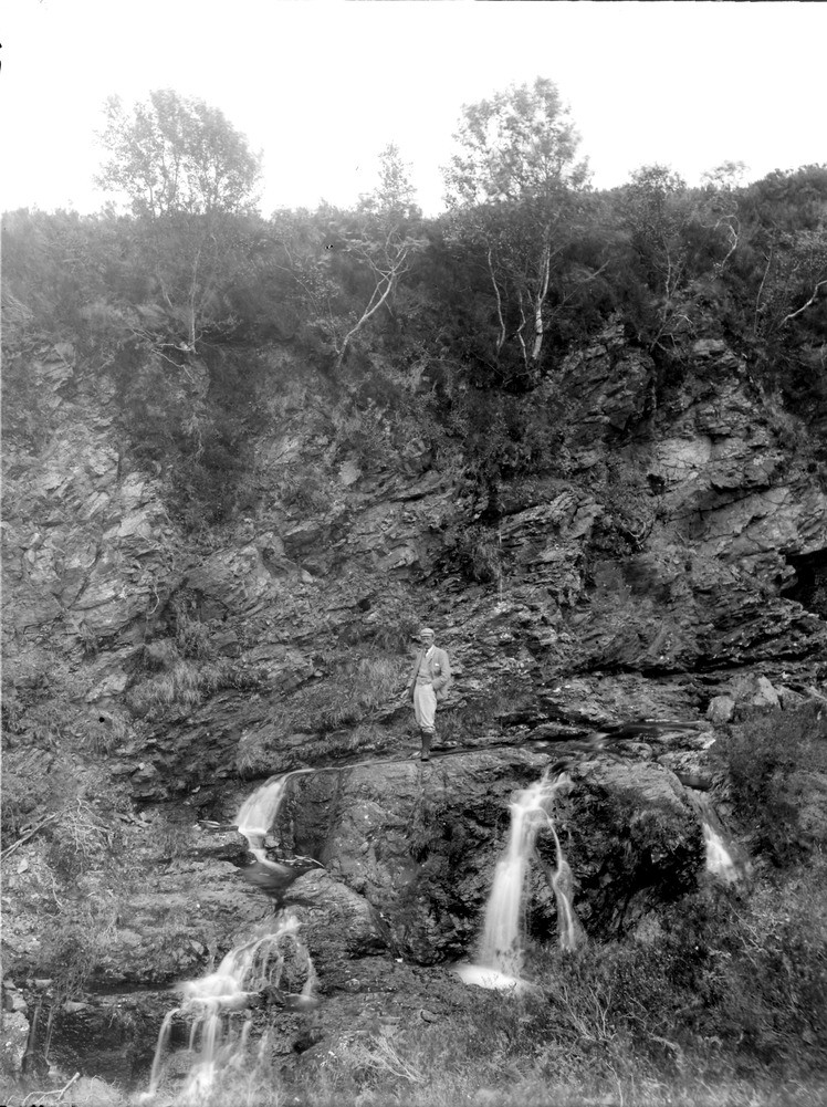
| Caption: | 1.2 km. west-north-west of Lochcarron village, Ross & Cromarty. An outcrop of Moine Thrust plane (the figure is standing upon the 'sole' of the thrust). The gneiss above is much more crushed and disturbed than that underlying the thrust plane. |
| Description: | 1.2 km. west-north-west of Lochcarron village, Ross & Cromarty. An outcrop of Moine Thrust plane (the figure is standing upon the 'sole' of the thrust). The gneiss above is much more crushed and disturbed than that underlying the thrust plane. The Moine Thrust is the highest of a series of thrusts stretching from Loch Eriboll to the north coast of Skye. Beneath the thrust is what was once called the 'Zone of Complication', a succession of several thrust bound nappes stacked one above the other. The zone comprises a sequence of thrusts, overfolded and faulted Cambrian-Ordovician sediments, Torridonian sediments and as in this photograph Lewisian gneiss. |
| Date taken: | Thu Jan 01 00:00:00 GMT 1891 |
| Photographer: | Lunn, R. |
| Copyright statement: | Crown |
| Acknowledgment: | This image was digitized with grant-in-aid from SCRAN the Scottish Cultural Resources Access Network |
| X longitude/easting: | 189000 |
| Y latitude/northing: | 840000 |
| Coordinate reference system, ESPG code: | 27700 (OSGB 1936 / British National Grid) |
| Orientation: | Portrait |
| Size: | 281.70 KB; 748 x 1001 pixels; 63 x 85 mm (print at 300 DPI); 198 x 265 mm (screen at 96 DPI); |
| Average Rating: | Not yet rated |
| Categories: | Unsorted Images, Geoscience subjects/ Structural features/ Thrusting |
Loading...
Loading...
Reviews
There is currently no feedback