| P number: | P001977 |
|---|---|
| Old photograph number: | C00566 |
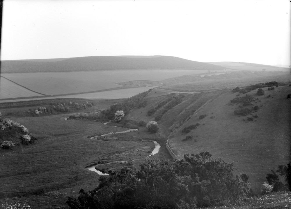
| Caption: | Spott Burn, 1.2 km. west of Spott Village, 4.0 km. south of Dunbar, East Lothian. |
| Description: | Junction of dry valley (on right) with main valley (on left), the latter now occupied by the Spott Burn. Both valleys are former glacial drainage channels, with that on the left now the route for minor modern drainage. The Spott Burn has meandered about to a certain extent but has not appreciably deepened the main valley since glacial times. Such U-shaped (dry) valleys are common in recently-glaciated terranes and indicate the former presence of a drainage pattern unrelated to modern topography. This was due to the natural drainage being restricted by the presence of large masses of stagnant and wasting ice occupying the low ground through which drainage would normally have flowed. Spott Burn (on left) demonstrating the small scale of the current watercourse occupying the valley. Part of a panorama with C00567. Description is for the whole panorama. |
| Date taken: | Fri Jan 01 00:00:00 GMT 1904 |
| Photographer: | Lunn, R. |
| Copyright statement: | Crown |
| Acknowledgment: | This image was digitized with grant-in-aid from SCRAN the Scottish Cultural Resources Access Network |
| X longitude/easting: | 366500 |
| Y latitude/northing: | 675500 |
| Coordinate reference system, ESPG code: | 27700 (OSGB 1936 / British National Grid) |
| Orientation: | Landscape |
| Size: | 139.67 KB; 1000 x 721 pixels; 85 x 61 mm (print at 300 DPI); 265 x 191 mm (screen at 96 DPI); |
| Average Rating: | Not yet rated |
| Categories: | Unsorted Images, Geoscience subjects/ Landforms, glaciation/ Overflow and marginal channels |
Loading...
Loading...
Reviews
There is currently no feedback