| P number: | P001974 |
|---|---|
| Old photograph number: | C00558 |
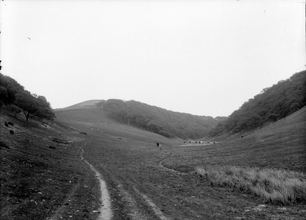
| Caption: | Rammer Cleugh, 1.6 km. north-east of Deuchrie Farm, 8.0 km. south-south-west of Dunbar, East Lothian. Dry valley. |
| Description: | Rammer Cleugh, 1.6 km. north-east of Deuchrie Farm, 8.0 km. south-south-west of Dunbar, East Lothian. Dry valley. Large dry valley, cut 60.96 m. deep, now containing insignificant natural drainage. This is evidence for the valley being a glacial drainage channel which was cut when the normal drainage was disrupted by glacial ice filling the main valley. These valleys are typically either completely dry (as here) or are occupied by a minor watercourse which is completely out of scale with the size of the valley, and could not possibly have eroded such a large feature. Such U-shaped dry valleys are common in recently glaciated terranes and indicate the former presence of a drainage pattern unrelated to modern topography. This was due to the natural drainage being restricted by the presence of large masses of stagnant and wasting ice occupying the low ground through which drainage would normally have flowed. |
| Date taken: | Fri Jan 01 00:00:00 GMT 1904 |
| Photographer: | Lunn, R. |
| Copyright statement: | Crown |
| Acknowledgment: | This image was digitized with grant-in-aid from SCRAN the Scottish Cultural Resources Access Network |
| X longitude/easting: | 363500 |
| Y latitude/northing: | 671500 |
| Coordinate reference system, ESPG code: | 27700 (OSGB 1936 / British National Grid) |
| Orientation: | Landscape |
| Size: | 153.81 KB; 1000 x 718 pixels; 85 x 61 mm (print at 300 DPI); 265 x 190 mm (screen at 96 DPI); |
| Average Rating: | Not yet rated |
| Categories: | Unsorted Images, Geoscience subjects/ Landforms, glaciation/ Overflow and marginal channels |
Loading...
Loading...
Reviews
There is currently no feedback