| P number: | P001971 |
|---|---|
| Old photograph number: | C00513 |
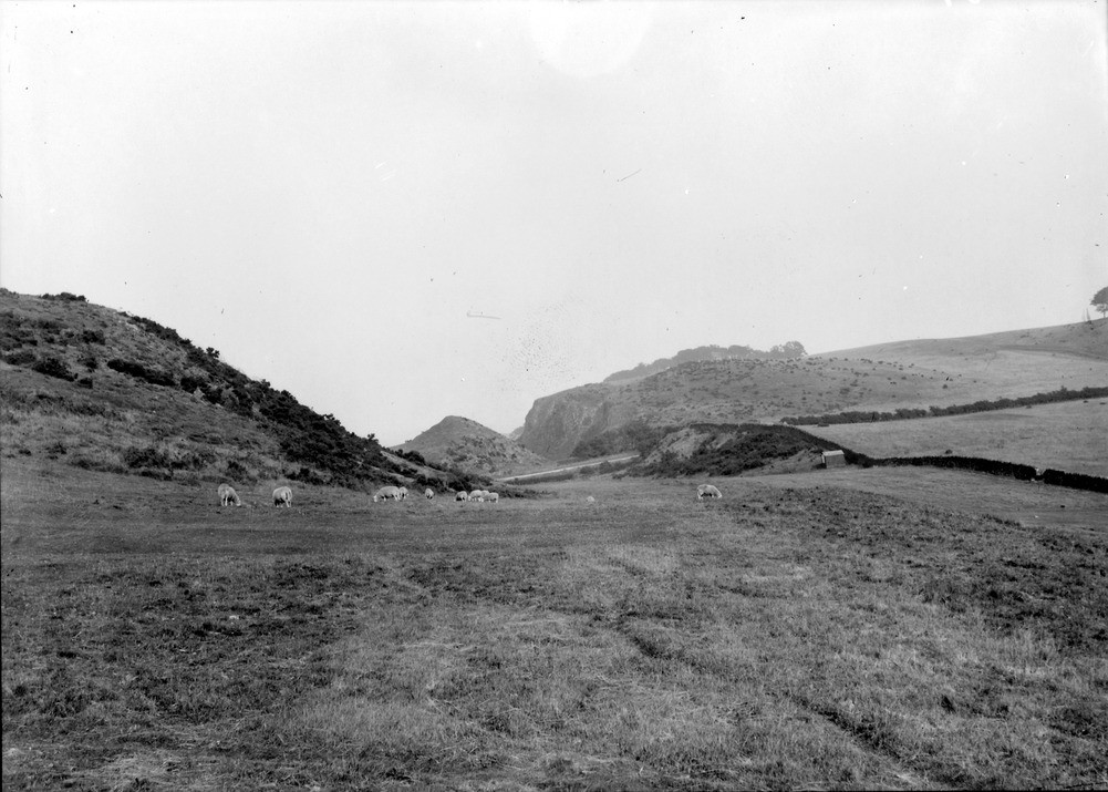
| Caption: | View from south side of Skid Hill, Garleton Hills, East Lothian. Looking east-north-east along glacial drainage channel cut in rock. |
| Description: | View from south side of Skid Hill, Garleton Hills, East Lothian. Looking east-north-east along glacial drainage channel cut in rock. The rock gully represents a glacial drainage channel, testifying to the erosive power of the huge volumes of water released as the ice sheets melted. The Garleton Hills must have formed a barrier to the ice during the Devensian so that the main glaciers flowed around it to the north and into the Forth estuary. When the ice began to recede, stagnant ice may have blocked the lower ground so that drainage for the large volumes of water became established around the margins of the ice sheet for melt water to flow away. This is evidenced by the numerous drainage channels cut in rock and boulder clay mapped out in the Garleton Hills. |
| Date taken: | Fri Jan 01 00:00:00 GMT 1904 |
| Photographer: | Lunn, R. |
| Copyright statement: | Crown |
| Acknowledgment: | This image was digitized with grant-in-aid from SCRAN the Scottish Cultural Resources Access Network |
| Orientation: | Landscape |
| Size: | 191.94 KB; 1001 x 715 pixels; 85 x 61 mm (print at 300 DPI); 265 x 189 mm (screen at 96 DPI); |
| Average Rating: | Not yet rated |
| Categories: | Unsorted Images, Geoscience subjects/ Landforms, glaciation/ Overflow and marginal channels |
Loading...
Loading...
Reviews
There is currently no feedback