| P number: | P001956 |
|---|---|
| Old photograph number: | C01707 |
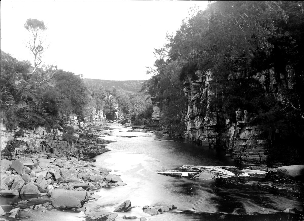
| Caption: | Dunbeath Water, 4.8 km. north-west of Dunbeath, Caithness. Postglacial gorge in Berriedale Flags. |
| Description: | Dunbeath Water, 4.8 km. north-west of Dunbeath, Caithness. Postglacial gorge in Berriedale Flags. Cliffs formed of thinly-bedded flaggy purple siltstones and sandstones belonging to the upper part of the Berriedale Sandstone Formation (Middle Devonian). The flagstones dip towards the camera at around 10 degrees. Subvertical joints are 1-2 m. apart. This narrow gorge has been cut by a river running from the gently-sloping inland plateau of Caithness to the sea in postglacial times. |
| Date taken: | Sat Jan 01 00:00:00 GMT 1910 |
| Photographer: | Lunn, R. |
| Copyright statement: | Crown |
| Acknowledgment: | This image was digitized with grant-in-aid from SCRAN the Scottish Cultural Resources Access Network |
| X longitude/easting: | 312500 |
| Y latitude/northing: | 932500 |
| Coordinate reference system, ESPG code: | 27700 (OSGB 1936 / British National Grid) |
| Orientation: | Landscape |
| Size: | 223.79 KB; 1001 x 728 pixels; 85 x 62 mm (print at 300 DPI); 265 x 193 mm (screen at 96 DPI); |
| Average Rating: | Not yet rated |
| Categories: | Unsorted Images, Geoscience subjects/ Landforms, river/ Gorges and ravines |
Loading...
Loading...
Reviews
There is currently no feedback