| P number: | P001950 |
|---|---|
| Old photograph number: | C01665 |
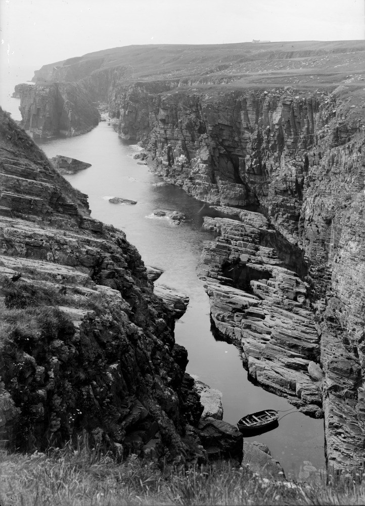
| Caption: | Looking south towards Hanni Geo from the Haven at the Clett, Bruan, 8 km. north-east of Lybster, Caithness. The stacks and geos, and the coast trend, are determined by small faults running parallel with the coastline. |
| Description: | Looking south towards Hanni Geo from the Haven at the Clett, Bruan, 8 km. north-east of Lybster, Caithness. The stacks and geos, and the coast trend, are determined by small faults running parallel with the coastline. Thinly-bedded flaggy purple siltstones and sandstones forming the upper part of the Berriedale Sandstone Formation (Middle Devonian) dip away from camera at about 20 degrees. They are cut by a minor north-south trending fault and associated fractures. Marine erosion along these fractures has formed a narrow inlet. A small stack occurs at the mouth of the inlet. |
| Date taken: | Sat Jan 01 00:00:00 GMT 1910 |
| Photographer: | Lunn, R. |
| Copyright statement: | Crown |
| Acknowledgment: | This image was digitized with grant-in-aid from SCRAN the Scottish Cultural Resources Access Network |
| X longitude/easting: | 331500 |
| Y latitude/northing: | 939500 |
| Coordinate reference system, ESPG code: | 27700 (OSGB 1936 / British National Grid) |
| Orientation: | Portrait |
| Size: | 255.54 KB; 722 x 1001 pixels; 61 x 85 mm (print at 300 DPI); 191 x 265 mm (screen at 96 DPI); |
| Average Rating: | Not yet rated |
| Categories: | Unsorted Images, Geoscience subjects/ Structural features/ Faulting |
Loading...
Loading...
Reviews
There is currently no feedback