| P number: | P001946 |
|---|---|
| Old photograph number: | C01634 |
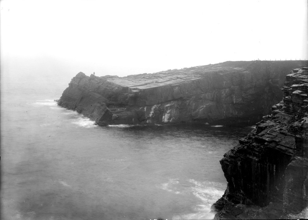
| Caption: | Helman Head, 4 km. south of Wick, Caithness. Exposed headland with sloping cliff swept clear of its covering of till, soil and vegetation. |
| Description: | Helman Head, 4 km. south of Wick, Caithness. Exposed headland with sloping cliff swept clear of its covering of till, soil and vegetation. The Helman Head Beds are a unit of thinly-bedded flaggy purple siltstones and sandstones forming the upper part of the Berriedale Sandstone Formation (Middle Devonian). In the photo they dip gently seaward at 5-10 degrees. Subvertical joints at 2-5 m. intervals are well seen on the top of the headland, where all till and vegetation cover has been removed by the sea washing over the headland during storms. |
| Date taken: | Sat Jan 01 00:00:00 GMT 1910 |
| Photographer: | Lunn, R. |
| Copyright statement: | Crown |
| Acknowledgment: | This image was digitized with grant-in-aid from SCRAN the Scottish Cultural Resources Access Network |
| X longitude/easting: | 336500 |
| Y latitude/northing: | 946500 |
| Coordinate reference system, ESPG code: | 27700 (OSGB 1936 / British National Grid) |
| Orientation: | Landscape |
| Size: | 112.94 KB; 1000 x 715 pixels; 85 x 61 mm (print at 300 DPI); 265 x 189 mm (screen at 96 DPI); |
| Average Rating: | Not yet rated |
| Categories: | Unsorted Images, Geoscience subjects/ Landforms, marine/ Headlands and islands |
Loading...
Loading...
Reviews
There is currently no feedback