| P number: | P223962 |
|---|---|
| Old photograph number: | LFP00609 |
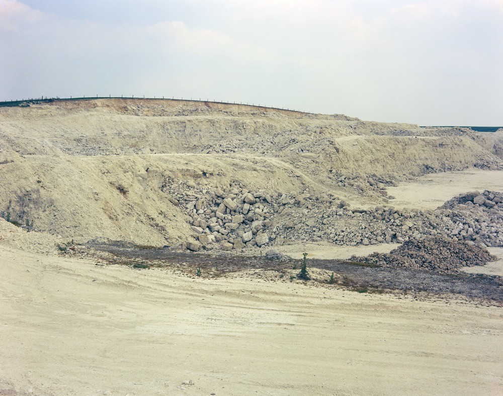
| Caption: | Nettleton Bottom Chalk Pit, Nettleton, near Caistor. Looking SE. |
| Description: | Nettleton Bottom Chalk Pit, Nettleton, near Caistor. Looking SE. Ferriby and Welton Chalks. This view shows the shattered and broken nature of the chalk within areas affected by cambering. Visible at top left is the Black Band, marking the base of the Welton Chalk. In the right-hand lower face a grey band can be seen which describes a very shallow anticline. |
| Date taken: | Tue Jul 01 00:00:00 BST 1975 |
| Photographer: | Thornton, K.E. |
| Copyright statement: | NERC |
| X longitude/easting: | 512540 |
| Y latitude/northing: | 398280 |
| Coordinate reference system, ESPG code: | 27700 (OSGB 1936 / British National Grid) |
| Orientation: | Landscape |
| Size: | 282.43 KB; 1000 x 788 pixels; 85 x 67 mm (print at 300 DPI); 265 x 208 mm (screen at 96 DPI); |
| Average Rating: | Not yet rated |
| Categories: | Best of BGS Images/ Images from the archives |
Loading...
Loading...
Reviews
There is currently no feedback