| P number: | P001923 |
|---|---|
| Old photograph number: | C01399 |
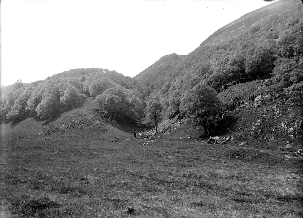
| Caption: | Upper Findhorn Valley, 0.8 km. upstream of Coignafearn (Old Lodge), Inverness-shire. Mouth of marginal glacial channel. |
| Description: | Upper Findhorn Valley, 0.8 km. upstream of Coignafearn (Old Lodge), Inverness-shire. Mouth of marginal glacial channel. Wooded gully is narrow channel cut by meltwaters during the deglaciation of the area. At that time it carried meltwater towards the Findhorn Valley at a time when it was still occupied by a valley glacier. The central channel runs right down to the Findhorn Valley, indicating that it was active until the Findhorn glacier had completely wasted away. Bedrock is biotite granodiorite of the Findhorn Pluton, containing abundant xenoliths of psammite and quartzite. |
| Date taken: | Sat Jan 01 00:00:00 GMT 1910 |
| Photographer: | Lunn, R. |
| Copyright statement: | Crown |
| Acknowledgment: | This image was digitized with grant-in-aid from SCRAN the Scottish Cultural Resources Access Network |
| X longitude/easting: | 271500 |
| Y latitude/northing: | 818500 |
| Coordinate reference system, ESPG code: | 27700 (OSGB 1936 / British National Grid) |
| Orientation: | Landscape |
| Size: | 250.78 KB; 1001 x 719 pixels; 85 x 61 mm (print at 300 DPI); 265 x 190 mm (screen at 96 DPI); |
| Average Rating: | Not yet rated |
| Categories: | Unsorted Images, Geoscience subjects/ Landforms, glaciation/ Overflow and marginal channels |
Loading...
Loading...
Reviews
There is currently no feedback