| P number: | P001921 |
|---|---|
| Old photograph number: | C01395 |
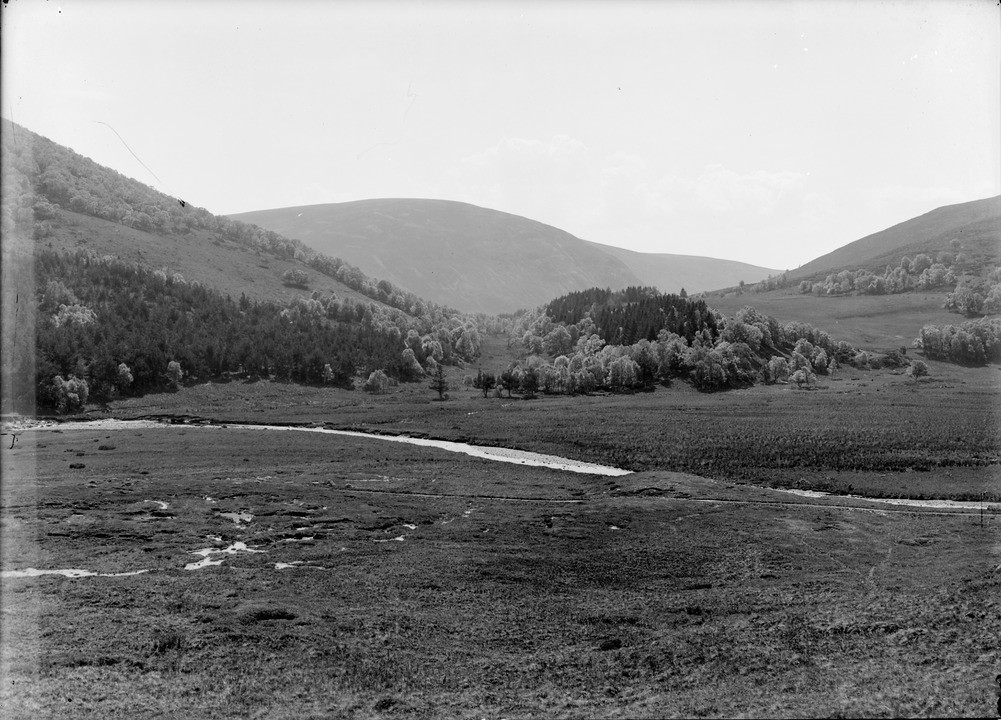
| Caption: | Looking south-south-east from hill-slope 1.6 km. north of Daltomach, Upper Findhorn Valley, Inverness-shire. |
| Description: | Partly-wooded valley filled with moundy glacial deposits, probably laid down in connection with the formation of the terminal moraine of the Findhorn glacier (photos C01396, C01397). Wooded hillock in centre is esker formed of sand and gravel deposited by a stream which flowed through the area after the deposition of the moraine. In foreground is alluvial plain of Glen Mazeran Burn. Note gentle slope upwards towards col. Bedrock is biotite granodiorite of the Findhorn Pluton as far as the River Findhorn. Distant hills are made of Grampian Group psammite and semipelite. Pre-glacial valley of the Glen Mazeran Burn partly filled with drift. The stream now flows into the River Findhorn below the hill to the left. |
| Date taken: | Sat Jan 01 00:00:00 GMT 1910 |
| Photographer: | Lunn, R. |
| Copyright statement: | Crown |
| Acknowledgment: | This image was digitized with grant-in-aid from SCRAN the Scottish Cultural Resources Access Network |
| X longitude/easting: | 274500 |
| Y latitude/northing: | 823500 |
| Coordinate reference system, ESPG code: | 27700 (OSGB 1936 / British National Grid) |
| Orientation: | Landscape |
| Size: | 219.77 KB; 1001 x 720 pixels; 85 x 61 mm (print at 300 DPI); 265 x 190 mm (screen at 96 DPI); |
| Average Rating: | Not yet rated |
| Categories: | Unsorted Images, Geoscience subjects/ Landforms, river/ Valleys |
Loading...
Loading...
Reviews
There is currently no feedback