| P number: | P001916 |
|---|---|
| Old photograph number: | C01366 |
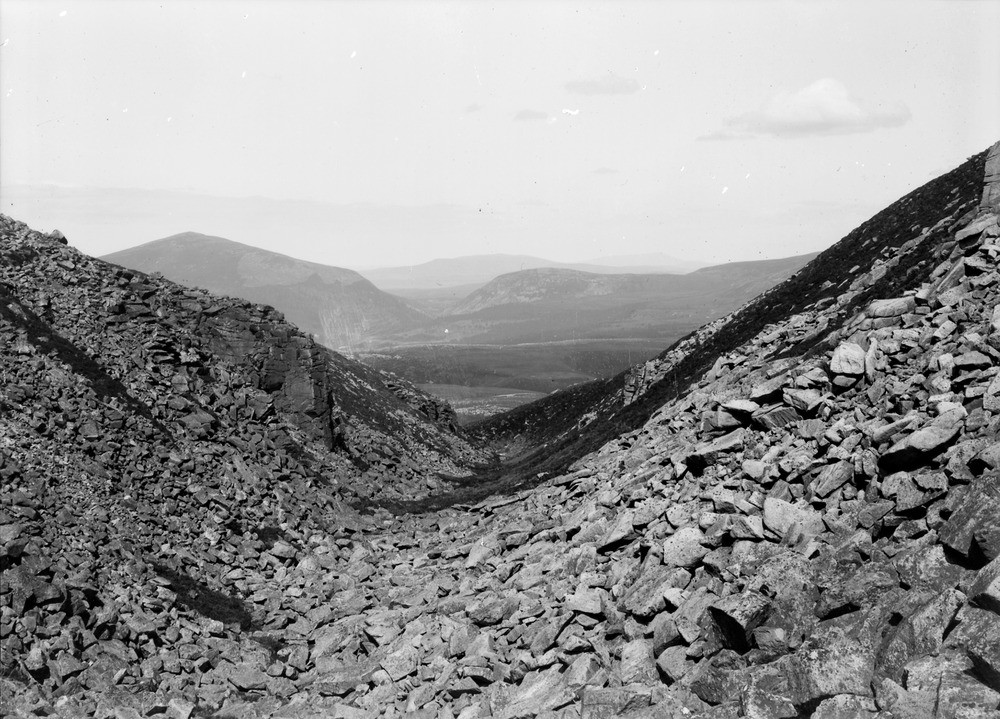
| Caption: | Creag a' Chalamain, Lairig Ghru, 10 km. south-east of Aviemore, Inverness-shire. V-shaped dry rock-gully (overflow channel across watershed). Another overflow channel (the Pass of Ryvoan) is seen in the distance. |
| Description: | Creag a' Chalamain, Lairig Ghru, 10 km. south-east of Aviemore, Inverness-shire. V-shaped dry rock-gully (overflow channel across watershed). Another overflow channel (the Pass of Ryvoan) is seen in the distance. Pink biotite granite belonging to Main Phase of the Cairngorm pluton, with widely-spaced vertical joints and closely-spaced later horizontal joints formed by pressure relief during unroofing well seen on cliffs to left. Overflow channel at a high level probably formed when ice sheet covered land surface, and etched into rock as ice sheet decayed. Note alignment with Pass of Ryvoan, an ice-widened valley, in distance. |
| Date taken: | Sat Jan 01 00:00:00 GMT 1910 |
| Photographer: | Lunn, R. |
| Copyright statement: | Crown |
| Acknowledgment: | This image was digitized with grant-in-aid from SCRAN the Scottish Cultural Resources Access Network |
| X longitude/easting: | 297500 |
| Y latitude/northing: | 799500 |
| Coordinate reference system, ESPG code: | 27700 (OSGB 1936 / British National Grid) |
| Orientation: | Landscape |
| Size: | 251.09 KB; 1000 x 719 pixels; 85 x 61 mm (print at 300 DPI); 265 x 190 mm (screen at 96 DPI); |
| Average Rating: | Not yet rated |
| Categories: | Unsorted Images, Geoscience subjects/ Landforms, weathering/ Rock weathering, Geoscience subjects/ Landforms, weathering/ Weathering along bedding. Joints, cleavage, Geoscience subjects/ Landforms, glaciation/ Overflow and marginal channels |
Loading...
Loading...
Reviews
There is currently no feedback