| P number: | P001910 |
|---|---|
| Old photograph number: | C01323 |
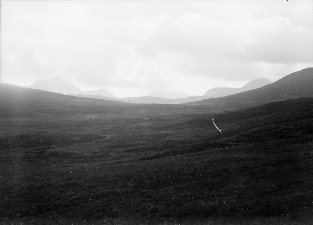
| Caption: | 6 km. west from the head of Loch Fannich, Ross & Cromarty. Wind-gap between Abhainn a' Chadh' Bhuidhe and Gleann Tanagaidh. |
| Description: | 6 km. west from the head of Loch Fannich, Ross & Cromarty. Wind-gap between Abhainn a' Chadh' Bhuidhe and Gleann Tanagaidh. This broad area of relatively low ground was a major channel for outflow of ice from the Fannich Mountains to the west. During the deglaciation, a relatively smooth cover of morainic material was deposited. This is now partly covered by peat. Bedrock here is psammite (metamorphosed sandstone) of the Moine Supergroup. The distant mountains lie to the west of the Moine Thrust Zone, and are made of Lewisian gneiss, Torridonian sandstone, and Cambrian quartzite. The principal mountains are Slioch (left), Beinn Lair (centre, distance), and Mullach Choire Mhic Fhearchair (right). |
| Date taken: | Sat Jan 01 00:00:00 GMT 1910 |
| Photographer: | Lunn, R. |
| Copyright statement: | Crown |
| Acknowledgment: | This image was digitized with grant-in-aid from SCRAN the Scottish Cultural Resources Access Network |
| Orientation: | Landscape |
| Size: | 105.78 KB; 1001 x 720 pixels; 85 x 61 mm (print at 300 DPI); 265 x 190 mm (screen at 96 DPI); |
| Average Rating: | Not yet rated |
| Categories: | Unsorted Images, Geoscience subjects/ Landforms, river/ River capture and diverted drainage |
Loading...
Loading...
Reviews
There is currently no feedback