| P number: | P001891 |
|---|---|
| Old photograph number: | C00319 |
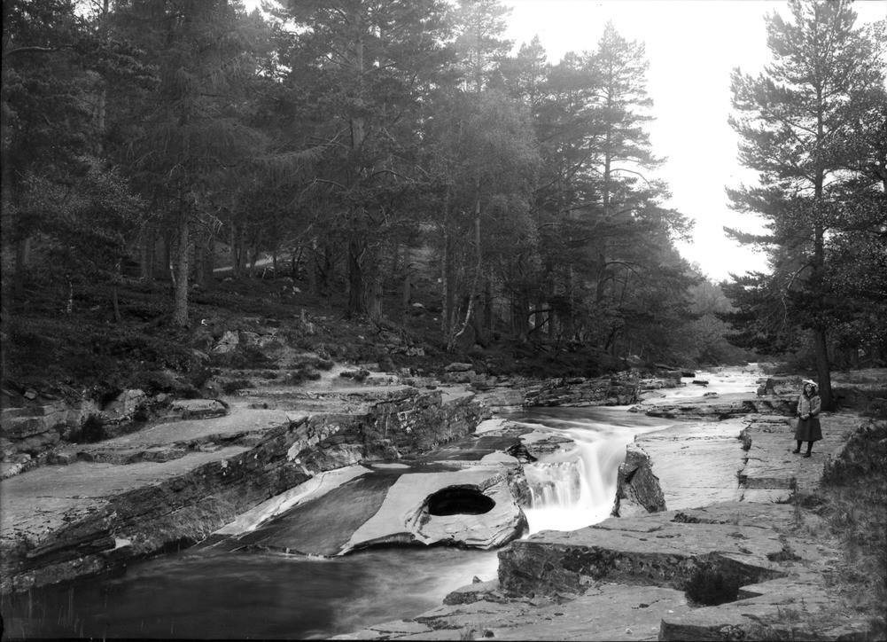
| Caption: | The Punch Bowl, Quoich Water, 3 km. west of Braemar, Aberdeenshire. 'Pot-hole' in Moine schists, probably due to rotating boulders. |
| Description: | The Punch Bowl, Quoich Water, 3 km. west of Braemar, Aberdeenshire. 'Pot-hole' in Moine schists, probably due to rotating boulders. Rocks exposed beside stream are flat-lying flaggy psammites (metamorphosed sandstones) of the Grampian Group. Note well-developed, widely spaced, vertical jointing. The Punch Bowl is in the centre of the stream, just right of large block. It is a rounded hollow, about two metres in diameter, formed by the action of a boulder or boulders, trapped in an eddy in the current, eroding the rocks as it is forced to rotate. |
| Date taken: | Sat Jan 01 00:00:00 GMT 1898 |
| Photographer: | Lunn, R. |
| Copyright statement: | Crown |
| Acknowledgment: | This image was digitized with grant-in-aid from SCRAN the Scottish Cultural Resources Access Network |
| X longitude/easting: | 311000 |
| Y latitude/northing: | 791000 |
| Coordinate reference system, ESPG code: | 27700 (OSGB 1936 / British National Grid) |
| Orientation: | Landscape |
| Size: | 248.50 KB; 1001 x 724 pixels; 85 x 61 mm (print at 300 DPI); 265 x 192 mm (screen at 96 DPI); |
| Average Rating: | Not yet rated |
| Categories: | Unsorted Images, Geoscience subjects/ Landforms, river/ Waterfalls and pot-holes |
Loading...
Loading...
Reviews
There is currently no feedback