| P number: | P001889 |
|---|---|
| Old photograph number: | C00297 |
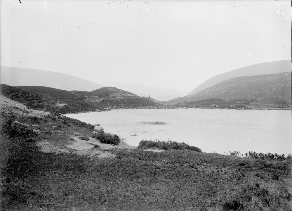
| Caption: | North end of Loch Callater, 7.5 km. south-south-east of Braemar, Aberdeenshire. Looking north-west. Typical example of a lake formed by a morainic barrier (local valley moraine). |
| Description: | North end of Loch Callater, 7.5 km. south-south-east of Braemar, Aberdeenshire. Looking north-west. Typical example of a lake formed by a morainic barrier (local valley moraine). Contact of Lochnagar Granite runs under loch. Hills in distance made of Gleann Beag Limestone (Ballachulish Subgroup) and Gleann Beag Schist (Blair Atholl Subgroup). Moundy glacial deposits (middle ground), possibly laid down as the terminal moraine of a valley glacier, have acted as a barrier to drainage and ponded the waters of Loch Callater behind them. |
| Date taken: | Sat Jan 01 00:00:00 GMT 1898 |
| Photographer: | Lunn, R. |
| Copyright statement: | Crown |
| Acknowledgment: | This image was digitized with grant-in-aid from SCRAN the Scottish Cultural Resources Access Network |
| X longitude/easting: | 317000 |
| Y latitude/northing: | 784000 |
| Coordinate reference system, ESPG code: | 27700 (OSGB 1936 / British National Grid) |
| Orientation: | Landscape |
| Size: | 182.69 KB; 1000 x 722 pixels; 85 x 61 mm (print at 300 DPI); 265 x 191 mm (screen at 96 DPI); |
| Average Rating: | Not yet rated |
| Categories: | Unsorted Images, Geoscience subjects/ Landforms, glaciation/ Moraines, Geoscience subjects/ Landforms, glaciation/ Glacial lakes and rock basins |
Loading...
Loading...
Reviews
There is currently no feedback