| P number: | P223349 |
|---|---|
| Old photograph number: | L03132 |
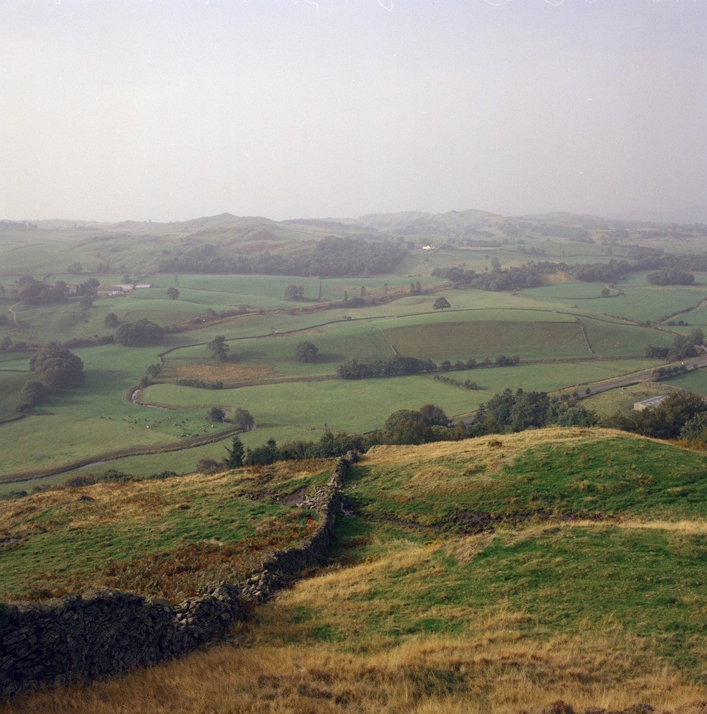
| Caption: | River Gowan and Brundriggs, Staveley. Looking SSW. |
| Description: | River Gowan and Brundriggs, Staveley. Looking SSW. Gowan Valley and Nether Staveley viewed from Reston Scar. The drumlin mound of Brundriggs forms the feature in the centre of the photograph and is surrounded by the alluvial plain of the River Gowan. A strip of hummocky boulder clay extends north from the railway and separates the alluvium from the folded mudstones and siltstones of the Bannisdale Formation which make up the wooded and rocky land in the background. |
| Date taken: | Sat Jan 01 00:00:00 GMT 1983 |
| Photographer: | Thornton, K.E. |
| Copyright statement: | NERC |
| X longitude/easting: | 345930 |
| Y latitude/northing: | 498780 |
| Coordinate reference system, ESPG code: | 27700 (OSGB 1936 / British National Grid) |
| Orientation: | Portrait |
| Size: | 287.30 KB; 990 x 1000 pixels; 84 x 85 mm (print at 300 DPI); 262 x 265 mm (screen at 96 DPI); |
| Average Rating: | Not yet rated |
| Categories: | Unsorted Images |
Loading...
Loading...
Reviews
There is currently no feedback