| P number: | P223326 |
|---|---|
| Old photograph number: | L03109 |
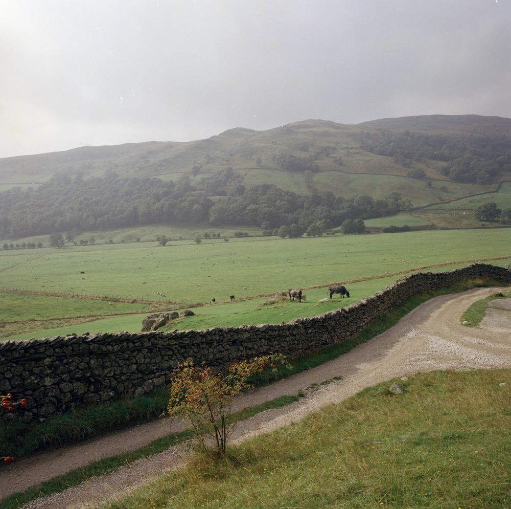
| Caption: | Kentmere Park viewed from Kentmere Church. Looking WSW. |
| Description: | Kentmere Park viewed from Kentmere Church. Looking WSW. General view across the Kentmere Valley towards Silurian strata of Kentmere Park. The prominent ridge centre top in photograph is formed by the cleaved calcareous siltstones of the Middle Coldwell Beds, dipping at 50 degrees to the left. The high ground to the right, including 'sallows' in the background is in the Brathay Flag Formation. Parkbrow Quarry can be seen in the centre of the photograph just above Hall Wood. |
| Date taken: | Sat Jan 01 00:00:00 GMT 1983 |
| Photographer: | Thornton, K.E. |
| Copyright statement: | NERC |
| X longitude/easting: | 345610 |
| Y latitude/northing: | 504090 |
| Coordinate reference system, ESPG code: | 27700 (OSGB 1936 / British National Grid) |
| Orientation: | Landscape |
| Size: | 295.75 KB; 1000 x 995 pixels; 85 x 84 mm (print at 300 DPI); 265 x 263 mm (screen at 96 DPI); |
| Average Rating: | Not yet rated |
| Categories: | Unsorted Images |
Loading...
Loading...
Reviews
There is currently no feedback