| P number: | P001865 |
|---|---|
| Old photograph number: | C00102 |
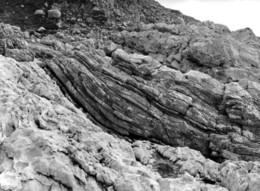
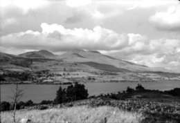
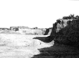
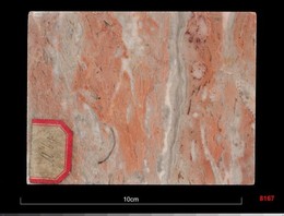
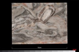
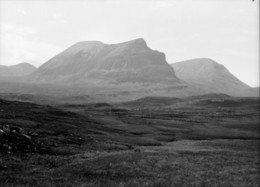
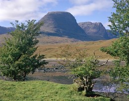
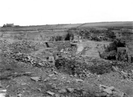
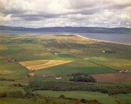
| Caption: | Beinn a' Chapuill, 4 km. south-south-east of Glenelg, Inverness-shire. The upper part of the mountain is formed of metamorphosed sandstones of the Moine Series, and the lower part of rocks of the Lewisian Gneiss Series. |
| Description: | Beinn a' Chapuill, 4 km. south-south-east of Glenelg, Inverness-shire. The upper part of the mountain is formed of metamorphosed sandstones of the Moine Series, and the lower part of rocks of the Lewisian Gneiss Series. Flat ground in foreground, in front of trees, is underlain by alluvial deposits. Lower poorly-exposed slopes beyond trees form part of the 'Eastern' Lewisian of the Glenelg Lewisian inlier, and are part of the Moine Nappe above the Moine Thrust. It is characterized by the abundance of metasedimentary rocks, including metalimestone and fayalite-magnetite rock, and also contains pods of eclogite. The upper half of the mountain, with abundant craggy exposures, is made of metamorphosed sandy rocks of the Morar Group of the Moine Supergroup. Due to intense deformation during the Caledonian orogeny, the layering in the two rock groups at the contact is roughly parallel and the original unconformity cannot be seen. |
| Date taken: | Sun Jan 01 00:00:00 GMT 1905 |
| Photographer: | Lunn, R. |
| Copyright statement: | Crown |
| Acknowledgment: | This image was digitized with grant-in-aid from SCRAN the Scottish Cultural Resources Access Network |
| X longitude/easting: | 182800 |
| Y latitude/northing: | 815300 |
| Coordinate reference system, ESPG code: | 27700 (OSGB 1936 / British National Grid) |
| Orientation: | Landscape |
| Size: | 182.44 KB; 1000 x 739 pixels; 85 x 63 mm (print at 300 DPI); 265 x 196 mm (screen at 96 DPI); |
| Average Rating: | Not yet rated |
| Categories: | Unsorted Images |
Loading...
Loading...
Reviews
There is currently no feedback