| P number: | P001864 |
|---|---|
| Old photograph number: | C00068 |
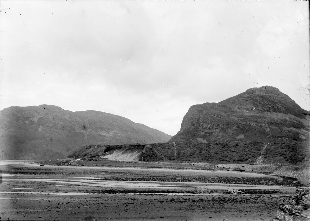
| Caption: | Portchuillin, 2.0 km. west of Stromeferry, Ross & Cromarty. Raised beaches, 9.14 m. and 30.48 m. Overturned Lewisian and Torridonian rocks in the Kishorn Nappe. |
| Description: | Portchuillin, 2.0 km. west of Stromeferry, Ross & Cromarty. Raised beaches, 9.14 m. and 30.48 m. Overturned Lewisian and Torridonian rocks in the Kishorn Nappe. Low ground in foreground is part of postglacial raised beach, here c. 9 m. above O.D. Platform in middle distance to left of crag is part of late-glacial raised beach, c. 30 m. above O.D. Sand and shingle are exposed in face directly under platform. Creag Mhaol, to right of late-glacial raised beach, is made of Lewisian gneiss with amphibolite sheets, lying over inverted grey sandstones and shales (Diabaig Formation, Torridonian) in the Kishorn Nappe. Hill in left distance, across Loch Carron, is made of inverted grey sandstones and shales (Diabaig Formation, Torridonian), also part of the Kishorn Nappe. |
| Date taken: | Thu Jan 01 00:00:00 GMT 1891 |
| Photographer: | Lunn, R. |
| Copyright statement: | Crown |
| Acknowledgment: | This image was digitized with grant-in-aid from SCRAN the Scottish Cultural Resources Access Network |
| X longitude/easting: | 186000 |
| Y latitude/northing: | 834000 |
| Coordinate reference system, ESPG code: | 27700 (OSGB 1936 / British National Grid) |
| Orientation: | Landscape |
| Size: | 165.27 KB; 1000 x 714 pixels; 85 x 60 mm (print at 300 DPI); 265 x 189 mm (screen at 96 DPI); |
| Average Rating: | Not yet rated |
| Categories: | Unsorted Images, Geoscience subjects/ Landforms, marine/ Raised beaches |
Loading...
Loading...
Reviews
There is currently no feedback