| P number: | P223190 |
|---|---|
| Old photograph number: | L02973 |
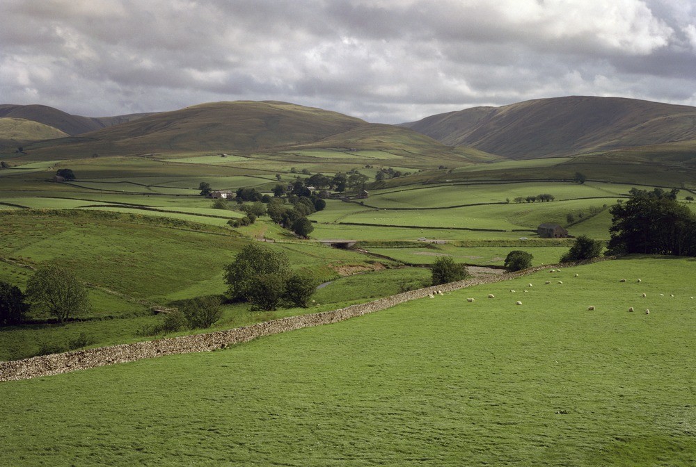
| Caption: | View across the upper Lune Valley to the Howgill Fells. |
| Description: | View across the upper Lune Valley to the Howgill Fells. View across the upper Lune Valley to the Howgill Fells. The river flows east to west approximately along the outcrop of the lowest beds in the Ravenstonedale Limestone. The fields beyond are underlain by Carboniferous Shap Conglomerate and Pinskey Gill Beds while the fells in the background are formed by Silurian Bannisdale Slates and Coniston Grits. |
| Date taken: | Thu Aug 12 00:00:00 BST 1982 |
| Photographer: | Thornton, K.E. |
| Copyright statement: | NERC |
| X longitude/easting: | 367700 |
| Y latitude/northing: | 505560 |
| Coordinate reference system, ESPG code: | 27700 (OSGB 1936 / British National Grid) |
| Orientation: | Landscape |
| Size: | 227.99 KB; 1000 x 672 pixels; 85 x 57 mm (print at 300 DPI); 265 x 178 mm (screen at 96 DPI); |
| Average Rating: | Not yet rated |
| Categories: | Unsorted Images, Geoscience subjects/ General views, Geoscience subjects/ Landforms, weathering/ Relict boulders and deposits, sarsens |
Loading...
Loading...
Reviews
There is currently no feedback