| P number: | P223188 |
|---|---|
| Old photograph number: | L02971 |
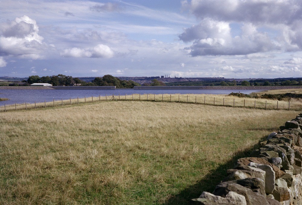
| Caption: | Airy Holm Dam and headpond, Kilnpit Hill, Northumberland. |
| Description: | Airy Holm Dam and headpond, Kilnpit Hill, Northumberland. Kielder Water Scheme (transfer works) - Airy Holm Dam and headpond. This headpond and dam, constructed mainly on drift-covered high Namurian sandstone, is a mass concrete gravity structure some 180 m. long by 13 m. high near the headwaters of Shotleyfield Burn. It forms a headpond on the tunnel discharge. Its capacity at peak is 250,000m3. The foreground is predominantly made ground. Consett in distance (old steelworks in process of being dismantled). |
| Date taken: | Thu Sep 23 00:00:00 BST 1982 |
| Photographer: | Thornton, K.E. |
| Copyright statement: | NERC |
| X longitude/easting: | 304380 |
| Y latitude/northing: | 554030 |
| Coordinate reference system, ESPG code: | 27700 (OSGB 1936 / British National Grid) |
| Orientation: | Landscape |
| Size: | 226.46 KB; 1000 x 680 pixels; 85 x 58 mm (print at 300 DPI); 265 x 180 mm (screen at 96 DPI); |
| Average Rating: | Not yet rated |
| Categories: | Unsorted Images, Geoscience subjects/ Sedimentary features/ Slumping |
Loading...
Loading...
Reviews
There is currently no feedback