| P number: | P001855 |
|---|---|
| Old photograph number: | C00042 |
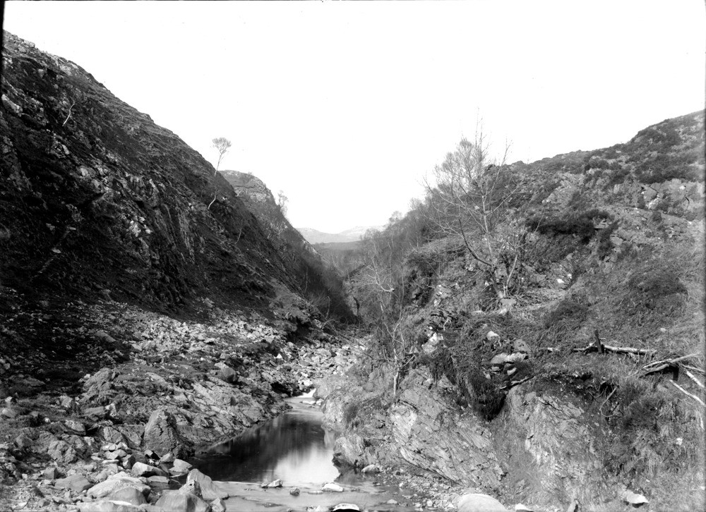
| Caption: | North-east of Tornapress, head of Loch Kishorn, looking north-west, Ross & Cromarty. Valley cut along outcrop of Kishorn thrust plane. Cambrian dolomite on left; Lower Torridon shale on right. |
| Description: | North-east of Tornapress, head of Loch Kishorn, looking north-west, Ross & Cromarty. Valley cut along outcrop of Kishorn thrust plane. Cambrian dolomite on left; Lower Torridon shale on right. The Cambrian rocks below the thrust (to the left) are grey limestones of the Eilean Dubh Formation (Durness Group). They are tightly folded and show signs of shattering along steeply-dipping fractures (dipping to right on photo at c. 50 degrees). Karstic weathering probably accounts for the largely dry river bed. The Torridonian rocks above the Kishorn thrust plane (right) belong to the Diabaig Formation, and contain more argillaceous beds than the Applecross Formation sandstones. The strata are inverted, and a short distance away to the east are overlain by Lewisian gneiss in the inverted limb of the Kishorn Nappe. |
| Date taken: | Thu Jan 01 00:00:00 GMT 1891 |
| Photographer: | Lunn, R. |
| Copyright statement: | Crown |
| Acknowledgment: | This image was digitized with grant-in-aid from SCRAN the Scottish Cultural Resources Access Network |
| X longitude/easting: | 183300 |
| Y latitude/northing: | 842300 |
| Coordinate reference system, ESPG code: | 27700 (OSGB 1936 / British National Grid) |
| Orientation: | Landscape |
| Size: | 239.26 KB; 1000 x 726 pixels; 85 x 61 mm (print at 300 DPI); 265 x 192 mm (screen at 96 DPI); |
| Average Rating: | Not yet rated |
| Categories: | Unsorted Images, Geoscience subjects/ Landforms, river/ Valleys |
Loading...
Loading...
Reviews
There is currently no feedback