| P number: | P001854 |
|---|---|
| Old photograph number: | C00041 |
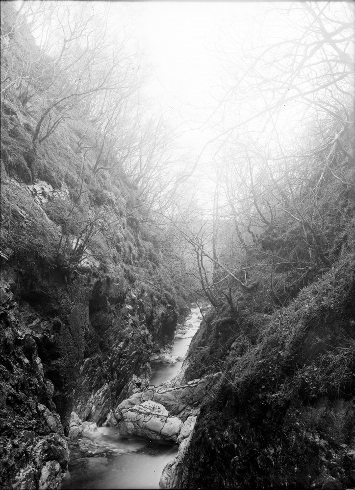
| Caption: | North-east of Tornapress, head of Loch Kishorn, looking north-west, Ross & Cromarty. Valley cut along outcrop of Kishorn thrust plane. Cambrian dolomite on right; Lower Torridon shale on left. |
| Description: | North-east of Tornapress, head of Loch Kishorn, looking north-west, Ross & Cromarty. Valley cut along outcrop of Kishorn thrust plane. Cambrian dolomite on right; Lower Torridon shale on left. Closely-spaced fractures dipping to the left at about 50 degrees just to the left of the large pale limestone exposure in the stream bed mark the approximate position of the Kishorn thrust. In the steep slopes on the left are exposures of argillaceous rocks of the Diabaig Formation (Torridonian), which are inverted and a short distance away to the east (left) are overlain by Lewisian gneiss in the inverted limb of the Kishorn Nappe. |
| Date taken: | Thu Jan 01 00:00:00 GMT 1891 |
| Photographer: | Lunn, R. |
| Copyright statement: | Crown |
| Acknowledgment: | This image was digitized with grant-in-aid from SCRAN the Scottish Cultural Resources Access Network |
| X longitude/easting: | 183300 |
| Y latitude/northing: | 842300 |
| Coordinate reference system, ESPG code: | 27700 (OSGB 1936 / British National Grid) |
| Orientation: | Portrait |
| Size: | 253.61 KB; 724 x 1001 pixels; 61 x 85 mm (print at 300 DPI); 192 x 265 mm (screen at 96 DPI); |
| Average Rating: | Not yet rated |
| Categories: | Unsorted Images, Geoscience subjects/ Landforms, river/ Gorges and ravines |
Loading...
Loading...
Reviews
There is currently no feedback