| P number: | P222936 |
|---|---|
| Old photograph number: | L02423 |
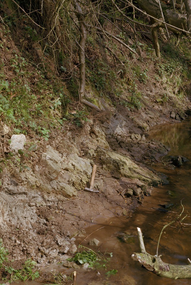
| Caption: | N. bank of Wych Brook. Looking N., viewed from S. bank, in Clwyd. |
| Description: | N. bank of Wych Brook. Looking N., viewed from S. bank, in Clwyd. Collapsed strata due to solution of Northwich Halite. Compact siltstone overlying mudstone dips steeply (left side of picture). Other detached blocks lying at various angles in a clay matrix are apparently part of a melange of such debris. This new outcrop position for the Lower Saliferous Beds is a radical reinterpretation of the evidence leading to a new map. |
| Date taken: | Tue Apr 01 00:00:00 BST 1980 |
| Photographer: | Thornton, K.E. |
| Copyright statement: | NERC |
| X longitude/easting: | 345500 |
| Y latitude/northing: | 344500 |
| Coordinate reference system, ESPG code: | 27700 (OSGB 1936 / British National Grid) |
| Orientation: | Portrait |
| Size: | 311.45 KB; 673 x 1000 pixels; 57 x 85 mm (print at 300 DPI); 178 x 265 mm (screen at 96 DPI); |
| Average Rating: | Not yet rated |
| Categories: | Unsorted Images |
Loading...
Loading...
Reviews
There is currently no feedback