| P number: | P001837 |
|---|---|
| Old photograph number: | B00899 |
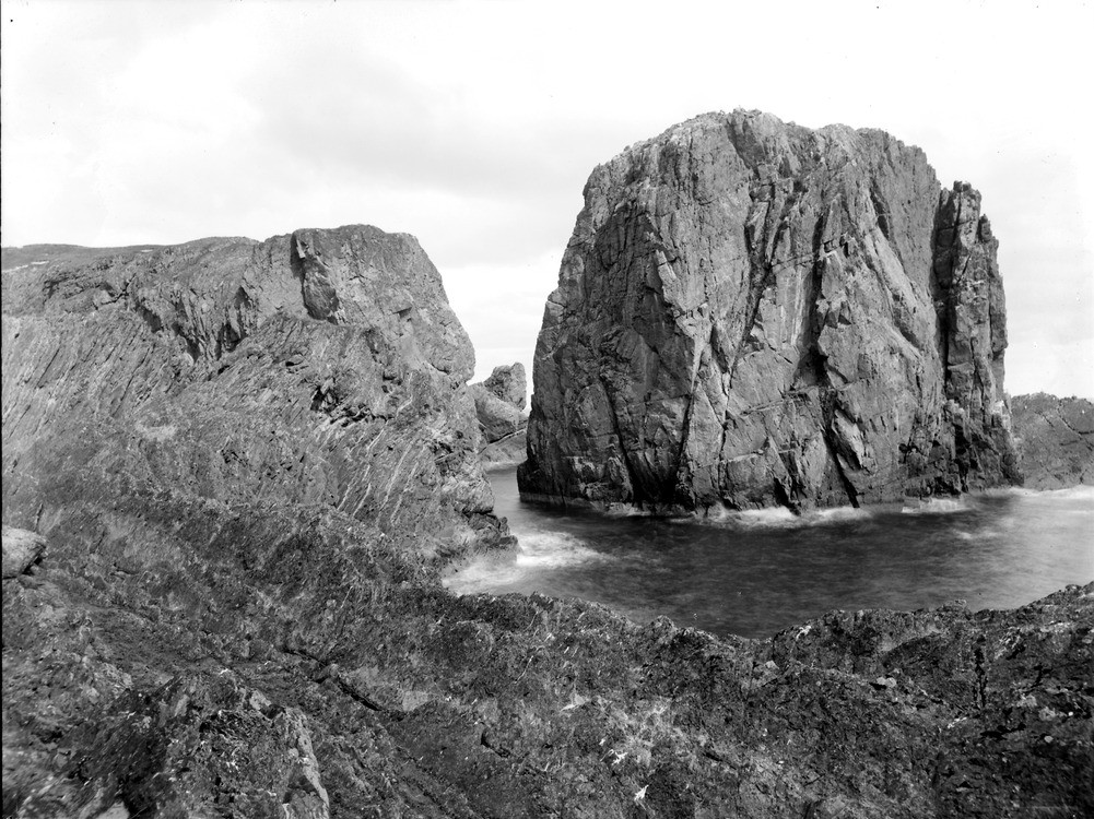
| Caption: | Stack of Ulbster, 1.5 km. east of Ulbster, Caithness. Stack of conglomerate. On the near side the Mill Burn fault enters the cliff; the mudstones dipping at high angles are seen on the near side of the fault. |
| Description: | Stack of Ulbster, 1.5 km. east of Ulbster, Caithness. Stack of conglomerate. On the near side the Mill Burn fault enters the cliff; the mudstones dipping at high angles are seen on the near side of the fault. Stack consists of massive conglomerate (Langwell Conglomerate Member) belonging to the Ousdale Arkose Formation of Lower Devonian age. Mudstones belonging to the Braemore Mudstone Formation have been tilted to steep dips near the Mill Burn Fault. They are exposed on the mainland in the near foreground. Still on the mainland, the Mill Burn Fault occupies the gully, and the cliff behind is made of conglomerate. |
| Date taken: | Mon Jan 01 00:00:00 GMT 1912 |
| Photographer: | Lunn, R. |
| Copyright statement: | Crown |
| Acknowledgment: | This image was digitized with grant-in-aid from SCRAN the Scottish Cultural Resources Access Network |
| X longitude/easting: | 333900 |
| Y latitude/northing: | 941600 |
| Coordinate reference system, ESPG code: | 27700 (OSGB 1936 / British National Grid) |
| Orientation: | Landscape |
| Size: | 267.54 KB; 1001 x 750 pixels; 85 x 64 mm (print at 300 DPI); 265 x 198 mm (screen at 96 DPI); |
| Average Rating: | Not yet rated |
| Categories: | Unsorted Images, Geoscience subjects/ Landforms, marine/ Stacks |
Loading...
Loading...
Reviews
There is currently no feedback