| P number: | P001824 |
|---|---|
| Old photograph number: | B00779 |
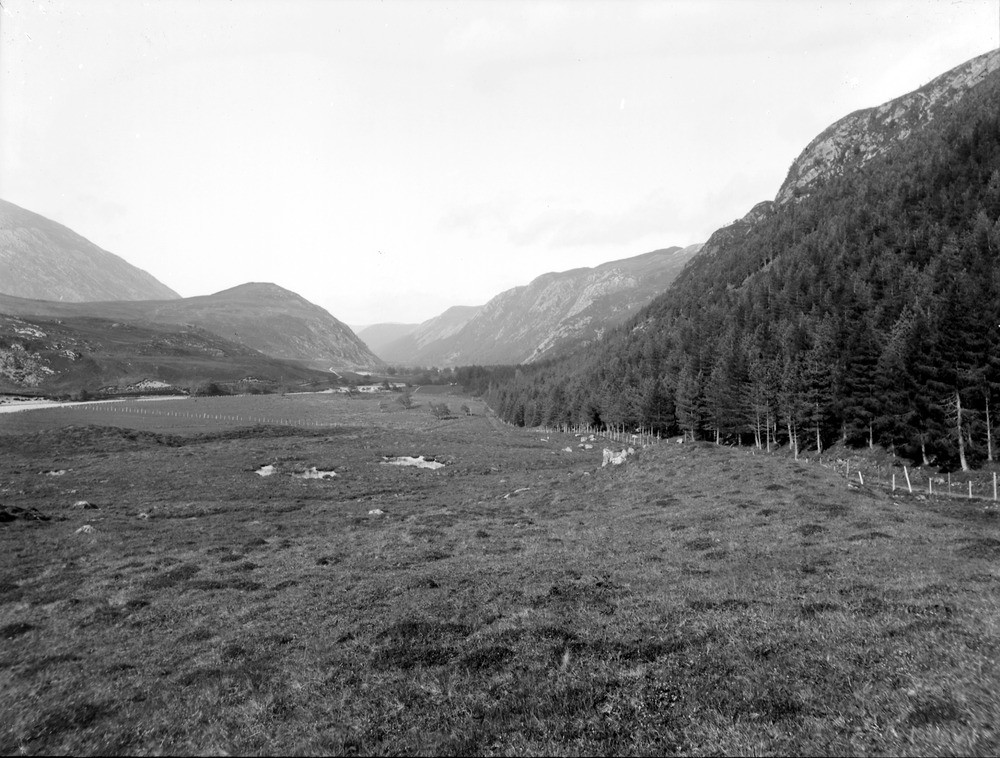
| Caption: | Looking north-north-east from near Inverchoran, Strath Conon. River valley developed along shatter belt of the Strathconon fault. |
| Description: | Looking north-north-east from near Inverchoran, Strath Conon. River valley developed along shatter belt of the Strathconon fault. The Strathconon Fault extends over 100 km. across Scotland from Loch Hourn to Garve and beyond. It is a strike-slip fault with a sinistral displacement of the order of 20 km. The rocks adjacent to the fault have been weakened by intense fracturing and the zones of weakness have been exploited by several rivers. Here the River Conon has excavated a steep-sided valley along the line of the fault between Inverchoran and Milltown. The rocks on the left side of the fault are pelites of the Moine Supergroup (?Glenfinnan Subgroup), while those on the right are Lewisian gneisses which have been thrust and folded along with the Moine rocks during the Caledonian Orogeny. |
| Date taken: | Wed Jan 01 00:00:00 GMT 1913 |
| Photographer: | Lunn, R. |
| Copyright statement: | Crown |
| Acknowledgment: | This image was digitized with grant-in-aid from SCRAN the Scottish Cultural Resources Access Network |
| X longitude/easting: | 225500 |
| Y latitude/northing: | 852500 |
| Coordinate reference system, ESPG code: | 27700 (OSGB 1936 / British National Grid) |
| Orientation: | Landscape |
| Size: | 219.19 KB; 1000 x 758 pixels; 85 x 64 mm (print at 300 DPI); 265 x 201 mm (screen at 96 DPI); |
| Average Rating: | Not yet rated |
| Categories: | Unsorted Images, Geoscience subjects/ Landforms, river/ Valleys, Geoscience subjects/ Landforms, river/ Valleys controlled by faults and shatter belts |
Loading...
Loading...
Reviews
There is currently no feedback