| P number: | P001821 |
|---|---|
| Old photograph number: | B00771 |
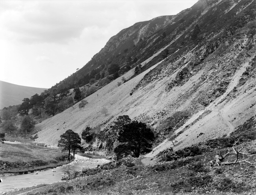
| Caption: | 3.5 km. south-south-east of Glenfeshie Lodge, 15 km. south-east of Kingussie, Inverness-shire. Crags and scree slopes of Grampian Group psammite. |
| Description: | 3.5 km. south-south-east of Glenfeshie Lodge, 15 km. south-east of Kingussie, Inverness-shire. Crags and scree slopes of Grampian Group psammite. Mountains made of Grampian Group psammite (metamorphosed sandstone). Note screes beneath crags. Footpath running across scree is vulnerable to landslipping. Handrail will help walkers to avoid falling when gravel moves, but is vulnerable to even minor slippage. Edge of flood plain of River Feshie at left. Isolated trees mark edge of great Caledonian pine forest. |
| Date taken: | Wed Jan 01 00:00:00 GMT 1913 |
| Photographer: | Lunn, R. |
| Copyright statement: | Crown |
| Acknowledgment: | This image was digitized with grant-in-aid from SCRAN the Scottish Cultural Resources Access Network |
| X longitude/easting: | 285500 |
| Y latitude/northing: | 790400 |
| Coordinate reference system, ESPG code: | 27700 (OSGB 1936 / British National Grid) |
| Orientation: | Landscape |
| Size: | 279.14 KB; 1000 x 763 pixels; 85 x 65 mm (print at 300 DPI); 265 x 202 mm (screen at 96 DPI); |
| Average Rating: | Not yet rated |
| Categories: | Unsorted Images, Geoscience subjects/ Landforms, weathering/ Screes and talus, Geoscience subjects/ Landforms, weathering/ Rock weathering |
Loading...
Loading...
Reviews
There is currently no feedback