| P number: | P001801 |
|---|---|
| Old photograph number: | B00725 |
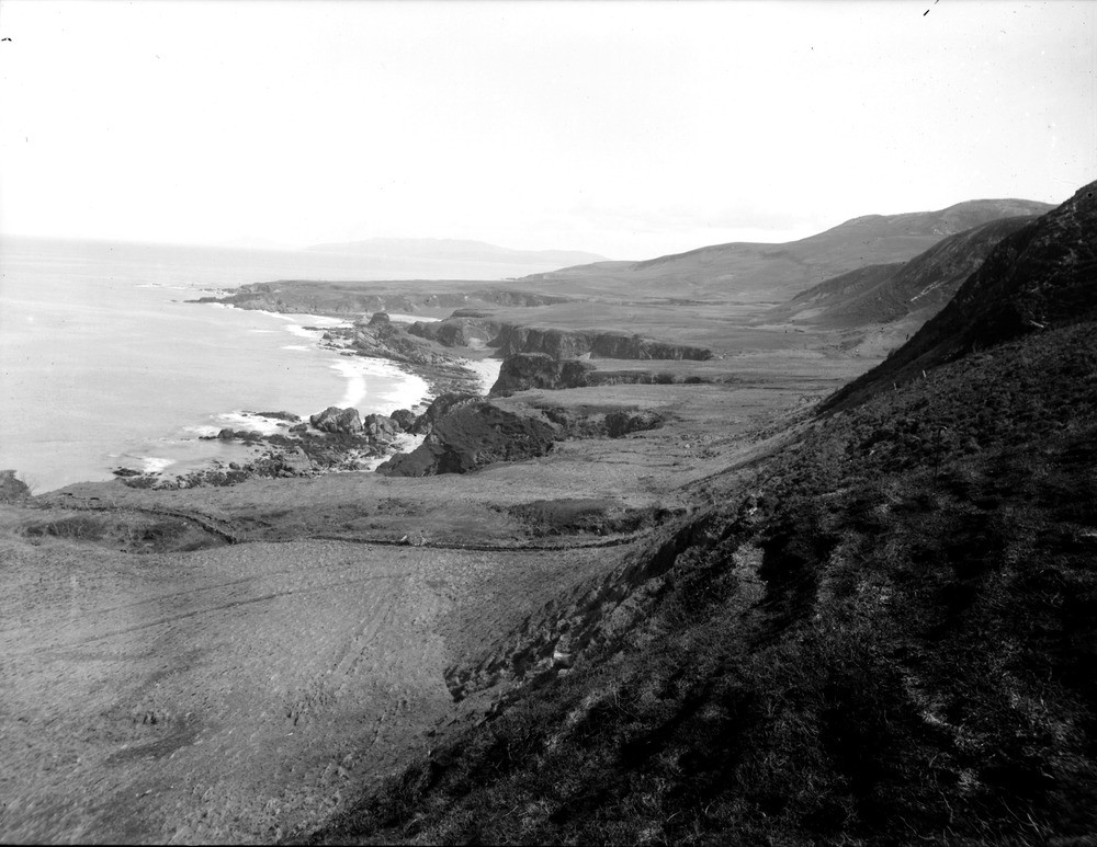
| Caption: | Looking east from Port a' Chotain, 4 km. west of Rhuvaal Lighthouse, north coast of Islay, Argyllshire. Pre-glacial rock-platform of marine erosion with overlying gravels of the late-glacial, raised beach. Pre-glacial cliff on right. |
| Description: | Looking east from Port a' Chotain, 4 km. west of Rhuvaal Lighthouse, north coast of Islay, Argyllshire. Pre-glacial rock-platform of marine erosion with overlying gravels of the late-glacial, raised beach. Pre-glacial cliff on right. Bedrock here consists of dolomitic mudstones and siltstones overlain by quartzite, belonging to the Bonahaven Dolomite and Jura Quartzite formations (Islay Subgroup, Argyll Group, Dalradian Supergroup). They dip gently south-west to south-east, and lie close to the axis of the Dhoruis Anticline. The flat grassy area is a rock platform, occupied by the sea in late-glacial times and is about 40 m. above O.D. On the right is the cliff which was attacked by the sea in late-glacial times. To the left of the grassy platform, is the cliff which formed the back of the postglacial raised beach. |
| Date taken: | Wed Jan 01 00:00:00 GMT 1913 |
| Photographer: | Lunn, R. |
| Copyright statement: | Crown |
| Acknowledgment: | This image was digitized with grant-in-aid from SCRAN the Scottish Cultural Resources Access Network |
| X longitude/easting: | 138500 |
| Y latitude/northing: | 678500 |
| Coordinate reference system, ESPG code: | 27700 (OSGB 1936 / British National Grid) |
| Orientation: | Landscape |
| Size: | 194.97 KB; 1000 x 773 pixels; 85 x 65 mm (print at 300 DPI); 265 x 205 mm (screen at 96 DPI); |
| Average Rating: | Not yet rated |
| Categories: | Unsorted Images, Geoscience subjects/ Landforms, marine/ Raised beaches |
Loading...
Loading...
Reviews
There is currently no feedback