| P number: | P001790 |
|---|---|
| Old photograph number: | B00691 |
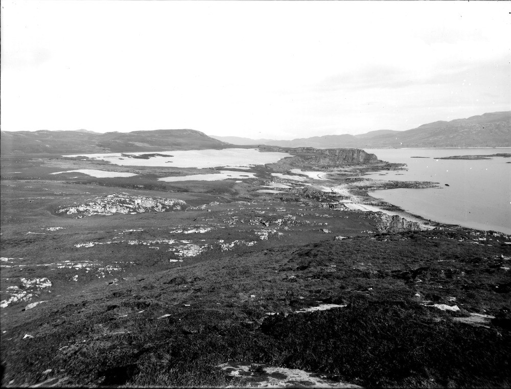
| Caption: | A little west of An Sailean, 0.805 km. east of Ruantallain, Loch Tarbert, west coast of Jura, Argyllshire. Large area of shingle of late-glacial raised beach, reaching 35 m. O.D., separated from postglacial raised beach by scarp. |
| Description: | A little west of An Sailean, 0.805 km. east of Ruantallain, Loch Tarbert, west coast of Jura, Argyllshire. Large area of shingle of late-glacial raised beach, reaching 35 m. O.D., separated from postglacial raised beach by scarp. Bedrock is Jura Quartzite (Islay Subgroup, Argyll Group, Dalradian Supergroup), dipping at 20 to 30 degrees away from camera. At right, close to sea, is platform of postglacial raised beach, c. 14 m. above O.D., merging in places with present-day storm beaches. Large patch of shingle in middle distance, to left of pronounced scarp, is late-glacial, here extending to a height of 35 m. O.D. |
| Date taken: | Wed Jan 01 00:00:00 GMT 1913 |
| Photographer: | Lunn, R. |
| Copyright statement: | Crown |
| Acknowledgment: | This image was digitized with grant-in-aid from SCRAN the Scottish Cultural Resources Access Network |
| X longitude/easting: | 150500 |
| Y latitude/northing: | 682500 |
| Coordinate reference system, ESPG code: | 27700 (OSGB 1936 / British National Grid) |
| Orientation: | Landscape |
| Size: | 208.81 KB; 1000 x 761 pixels; 85 x 64 mm (print at 300 DPI); 265 x 201 mm (screen at 96 DPI); |
| Average Rating: | Not yet rated |
| Categories: | Unsorted Images, Geoscience subjects/ Landforms, marine/ Raised beaches |
Loading...
Loading...
Reviews
There is currently no feedback