| P number: | P001749 |
|---|---|
| Old photograph number: | B00453 |
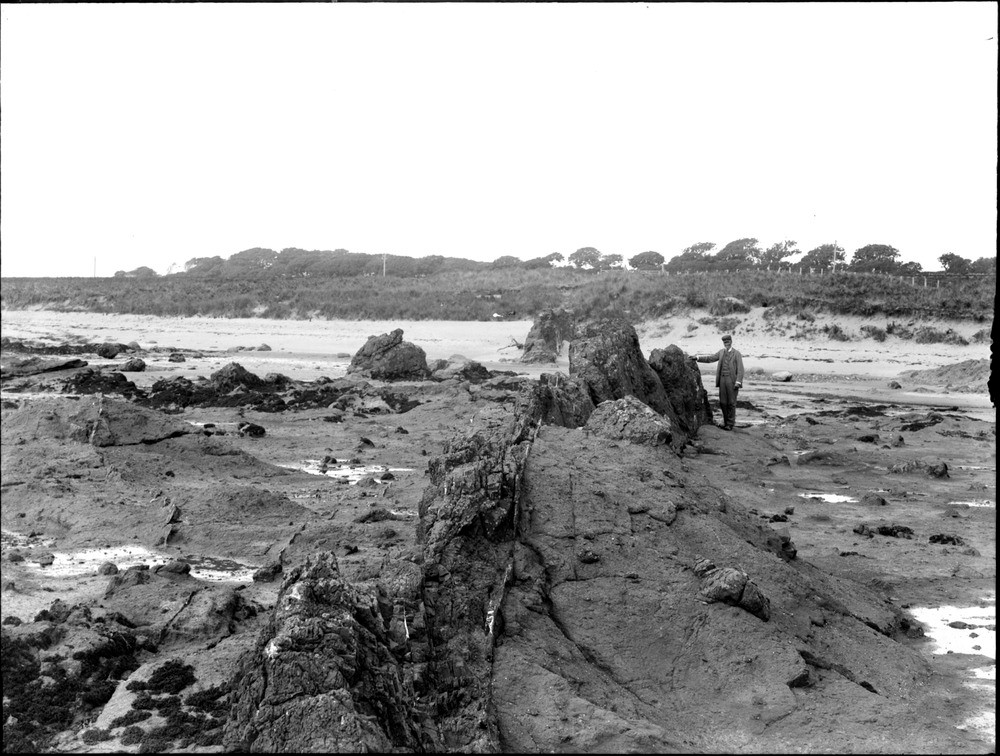
| Caption: | Ardross shore, 3 km. east of Elie, Fifeshire. Vertical basalt dyke traversing the agglomerate of 'Ardross Neck'. |
| Description: | Ardross shore, 3 km. east of Elie, Fifeshire. Vertical basalt dyke traversing the agglomerate of 'Ardross Neck'. Basaltic dyke is about 3 m. wide in foreground. It can be traced to left of boulders beside figure, and extends across sandy area. The margins are darker-coloured and finer-grained than the centre. Joints in dyke are only a few cm. apart. Veins of ?calcite have been intruded within and along contact of dyke. Agglomerate consists of basaltic fragments up to 1 m. across set in a fine-grained basaltic matrix, which is much softer than the basalt of the dyke. Joints in agglomerate are very widely spaced, and many are filled with calcite or quartz. |
| Date taken: | Tue Jan 01 00:00:00 GMT 1895 |
| Photographer: | Lunn, R. |
| Copyright statement: | Crown |
| Acknowledgment: | This image was digitized with grant-in-aid from SCRAN the Scottish Cultural Resources Access Network |
| X longitude/easting: | 350900 |
| Y latitude/northing: | 700900 |
| Coordinate reference system, ESPG code: | 27700 (OSGB 1936 / British National Grid) |
| Orientation: | Landscape |
| Size: | 220.88 KB; 1000 x 756 pixels; 85 x 64 mm (print at 300 DPI); 265 x 200 mm (screen at 96 DPI); |
| Average Rating: | Not yet rated |
| Categories: | Unsorted Images, Geoscience subjects/ Igneous features/ Dykes |
Loading...
Loading...
Reviews
There is currently no feedback