| P number: | P001739 |
|---|---|
| Old photograph number: | B00406 |
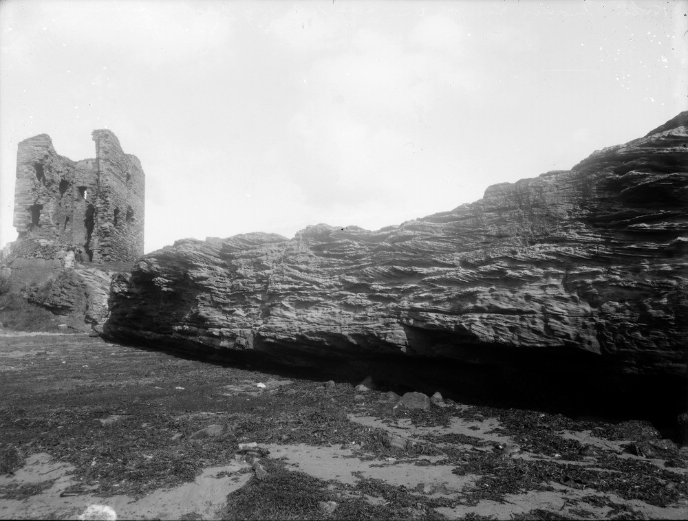
| Caption: | Seafield Tower, 1.5 km. north of Kinghorn, Fifeshire. Cliff of cross-bedded sandstone resting on limestone, and undercut by the sea. |
| Description: | Seafield Tower, 1.5 km. north of Kinghorn, Fifeshire. Cliff of cross-bedded sandstone resting on limestone, and undercut by the sea. Sandstone, cross-bedded in 0.3-0.5 m. units and underlying Blackhall Limestone lie within the Lower Limestone Formation (Strathclyde Group). Seafield Tower is a ruined tower house. About 1 km. north from here is the site of Seafield Colliery, sunk to exploit coal seams in the Coal Measures under the Firth of Forth. |
| Date taken: | Tue Jan 01 00:00:00 GMT 1895 |
| Photographer: | Lunn, R. |
| Copyright statement: | Crown |
| Acknowledgment: | This image was digitized with grant-in-aid from SCRAN the Scottish Cultural Resources Access Network |
| X longitude/easting: | 327900 |
| Y latitude/northing: | 688500 |
| Coordinate reference system, ESPG code: | 27700 (OSGB 1936 / British National Grid) |
| Orientation: | Landscape |
| Size: | 196.18 KB; 1000 x 758 pixels; 85 x 64 mm (print at 300 DPI); 265 x 201 mm (screen at 96 DPI); |
| Average Rating: | Not yet rated |
| Categories: | Unsorted Images, Geoscience subjects/ Sedimentary features/ False-bedding, cross, current and dune |
Loading...
Loading...
Reviews
There is currently no feedback