| P number: | P001679 |
|---|---|
| Old photograph number: | B00093 |
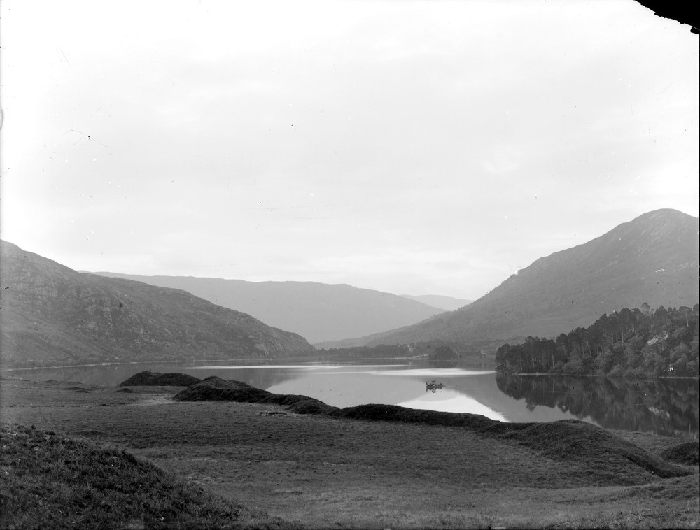
| Caption: | Loch Clair, 5.230 km. south-west of Kinlochewe, Ross & Cromarty. Kishorn thrust runs through loch, separating foreland on the right from Kishorn Nappe to the left. Sinuous esker in foreground. |
| Description: | Loch Clair, 5.230 km. south-west of Kinlochewe, Ross & Cromarty. Kishorn thrust runs through loch, separating foreland on the right from Kishorn Nappe to the left. Sinuous esker in foreground. Sgurr Dubh, the hill to the right of the loch, is made of Torridonian sandstone overlain by Cambrian quartzite, which have been folded together and cut by small thrusts. The Kishorn thrust runs underneath the loch, dipping to the left, and the hill to the left is made of inverted Torridonian strata overlain by a thin layer of Lewisian gneiss. At near side of loch, the sinuous ridge is probably an esker, i.e. a deposit of sand and gravel laid down by meltwater flowing in a channel within a glacier, and then dropped down onto the land surface when the ice melted. |
| Date taken: | Thu Jan 01 00:00:00 GMT 1891 |
| Photographer: | Lunn, R. |
| Copyright statement: | Crown |
| Acknowledgment: | This image was digitized with grant-in-aid from SCRAN the Scottish Cultural Resources Access Network |
| X longitude/easting: | 200100 |
| Y latitude/northing: | 857500 |
| Coordinate reference system, ESPG code: | 27700 (OSGB 1936 / British National Grid) |
| Orientation: | Landscape |
| Size: | 120.89 KB; 1000 x 758 pixels; 85 x 64 mm (print at 300 DPI); 265 x 201 mm (screen at 96 DPI); |
| Average Rating: | Not yet rated |
| Categories: | Unsorted Images, Geoscience subjects/ Landforms, glaciation/ Moraines |
Loading...
Loading...
Reviews
There is currently no feedback