| P number: | P222800 |
|---|---|
| Old photograph number: | L02200 |
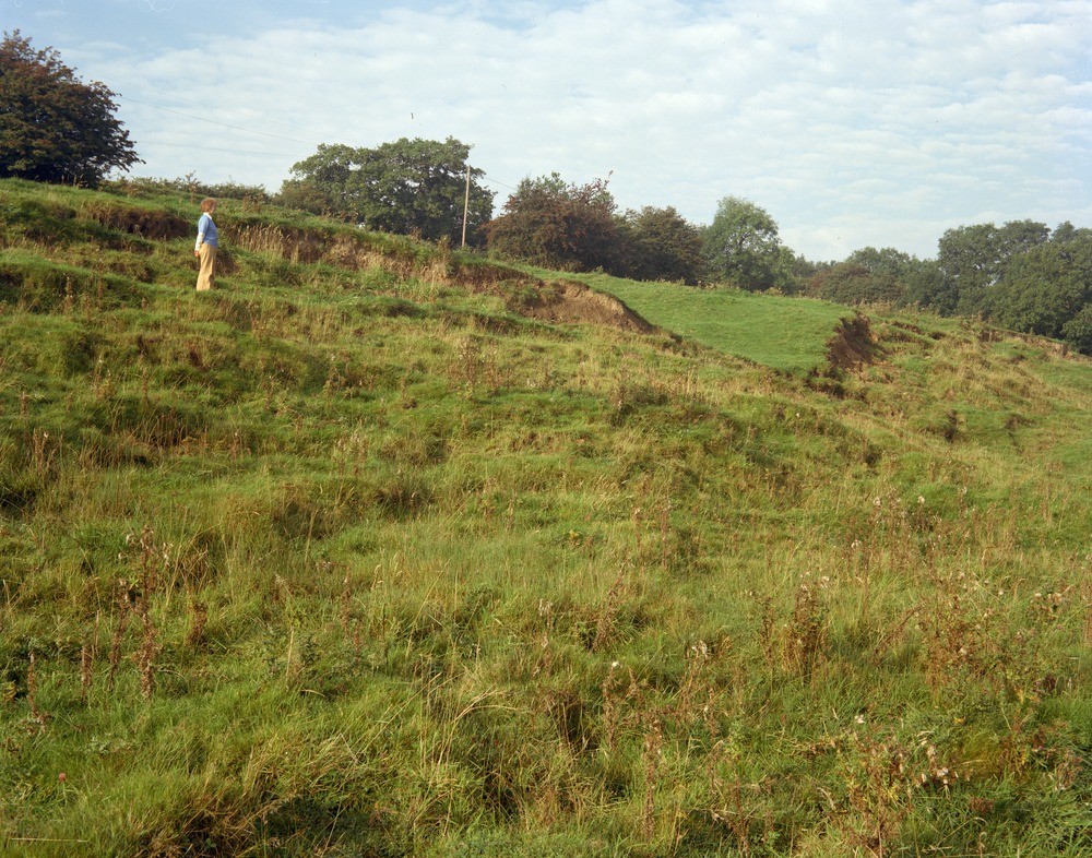
| Caption: | SW side of Bottom Flash e. of Weavergreen, looking NW along valley side. |
| Description: | SW side of Bottom Flash e. of Weavergreen, looking NW along valley side. Recent landslip scars show that subsidence due to salt solution may continue long after pumping of natural brine has ceased. Brine pumping at Winsford causes the Winsford 'flashes' - subsidence lakes where the River Weaver crosses subsided ground - and the pumping had virtually ceased some 20 years before the photograph was taken. |
| Date taken: | Sun Oct 01 00:00:00 BST 1978 |
| Photographer: | Thornton, K.E. |
| Copyright statement: | NERC |
| X longitude/easting: | 366000 |
| Y latitude/northing: | 364900 |
| Coordinate reference system, ESPG code: | 27700 (OSGB 1936 / British National Grid) |
| Orientation: | Landscape |
| Size: | 338.76 KB; 1000 x 786 pixels; 85 x 67 mm (print at 300 DPI); 265 x 208 mm (screen at 96 DPI); |
| Average Rating: | Not yet rated |
| Categories: | Unsorted Images, Geoscience subjects/ Landforms, weathering/ Landslips, Geoscience subjects/ Geohazards/ Subsidence |
Loading...
Loading...
Reviews
There is currently no feedback