| P number: | P222798 |
|---|---|
| Old photograph number: | L02198 |
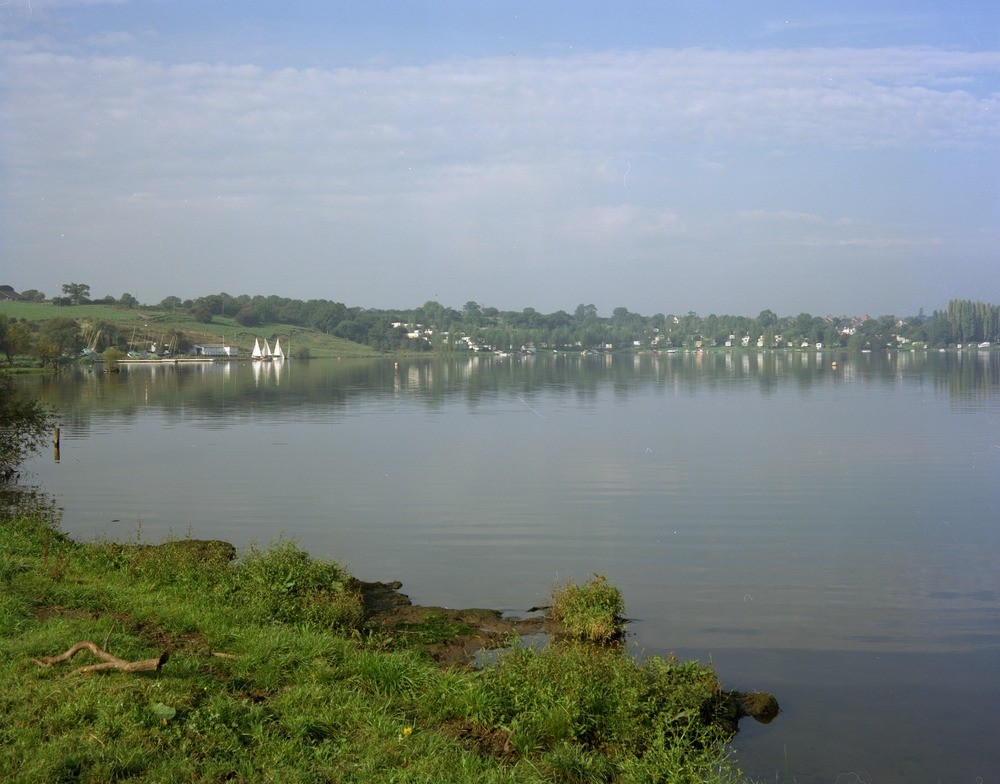
| Caption: | Subsidence at Bottom Flash near Winsford, Cheshire. |
| Description: | General view from the south of Bottom Flash sowing the effects of subsidence, the photograph shows the widening out of the River Weaver where it flows across a belt of subsided ground affected by salt solution. Recent landslip scars visible on the bank beyond the sailing club (left) show that subsidence once artificially induced by pumping 'wild brine' may continue long after pumping has ceased. The main pumping centres were in Winsford, in the distance (right), and pumping ceased many years before the photograph was taken. Some of the landslip scars are less than a year old. From ancient times man has sunk wells to the salt to win natural brine and the saltfields became notorious for the heavy surface damage caused by subsidence. Salt was also mined in the Winsford area for de-icing roads and to a lesser extent for cattle salt-licks. |
| Date taken: | Sun Oct 01 00:00:00 BST 1978 |
| Photographer: | Thornton, K.E. |
| Copyright statement: | NERC |
| X longitude/easting: | 366400 |
| Y latitude/northing: | 364900 |
| Coordinate reference system, ESPG code: | 27700 (OSGB 1936 / British National Grid) |
| Orientation: | Landscape |
| Size: | 164.43 KB; 1000 x 784 pixels; 85 x 66 mm (print at 300 DPI); 265 x 207 mm (screen at 96 DPI); |
| Average Rating: | Not yet rated |
| Categories: | Unsorted Images, Geoscience subjects/ Geohazards/ Subsidence |
Loading...
Loading...
Reviews
There is currently no feedback