| P number: | P222716 |
|---|---|
| Old photograph number: | L02026 |
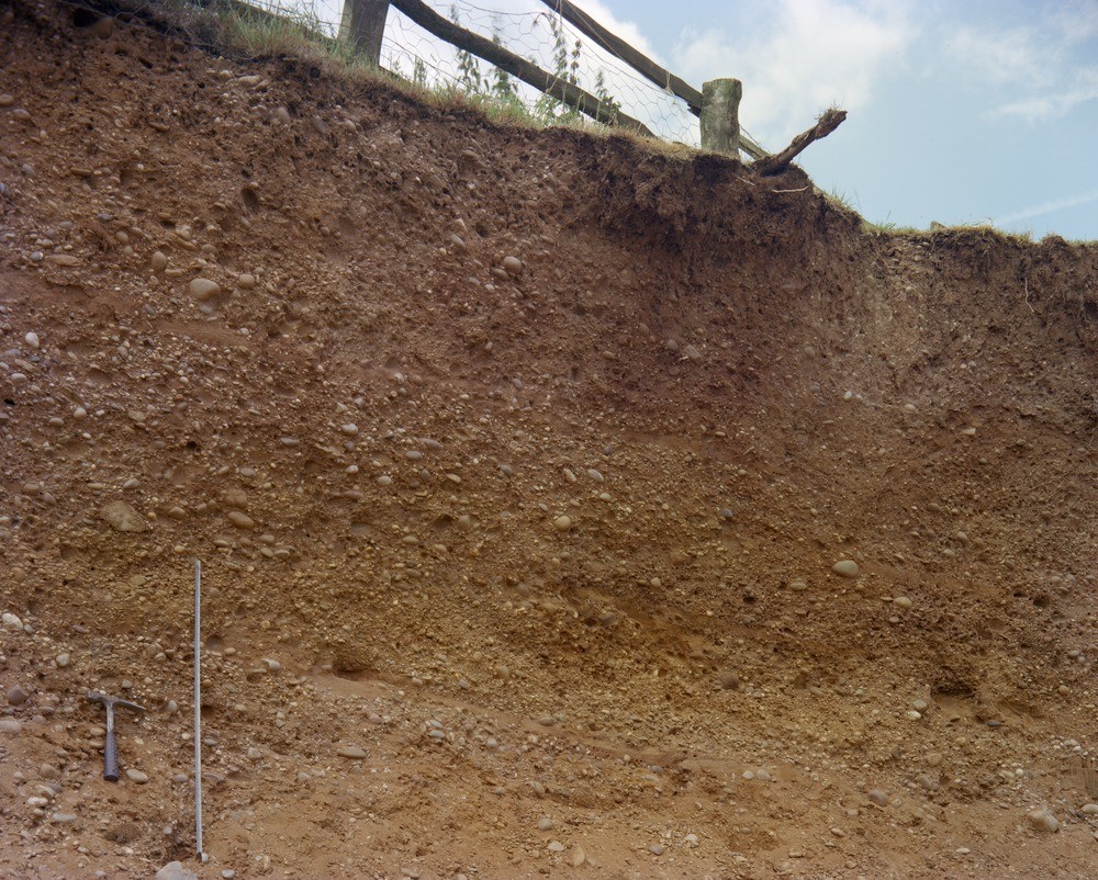
| Caption: | Gravel Pit, Leighbank Farm, Lower Tean. Looking SE. |
| Description: | Gravel Pit, Leighbank Farm, Lower Tean. Looking SE. Section in glacial gravel, Lower Tean. The section shows crudely stratified gravels with scattered sand bands up to 11 cm. The pebbles consist mainly of well-rounded Trias-derived quartz and quartzites, but scattered Triassic siltstone and sandstone, Carboniferous ironstone and mudstone clasts also occur. The gentle dip to the right (south-west) may not be original. Out of the photo to the left the gravels appear to be overlain by till, but the relationship is not clear. The ground surface above the pit indicates that any original feature marking the boundary between gravel and till has been planed off. |
| Date taken: | Sun May 01 00:00:00 BST 1977 |
| Photographer: | Thornton, K.E. |
| Copyright statement: | NERC |
| X longitude/easting: | 402050 |
| Y latitude/northing: | 337600 |
| Coordinate reference system, ESPG code: | 27700 (OSGB 1936 / British National Grid) |
| Orientation: | Landscape |
| Size: | 338.10 KB; 1000 x 802 pixels; 85 x 68 mm (print at 300 DPI); 265 x 212 mm (screen at 96 DPI); |
| Average Rating: | Not yet rated |
| Categories: | Unsorted Images |
Loading...
Loading...
Reviews
There is currently no feedback