| P number: | P222534 |
|---|---|
| Old photograph number: | L01731 |
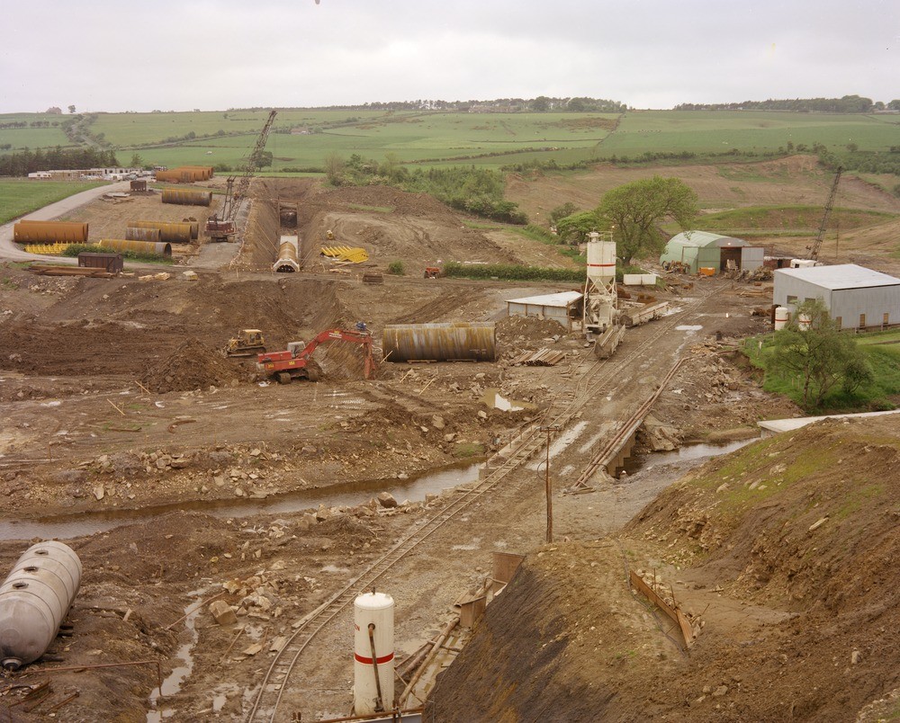
| Caption: | Kielder Water Scheme - 'cut and cover' pipeline section across Derwent Valley. River Derwent Valley near Eddy's Bridge Farm, near Edmundbyers, Durham. |
| Description: | View looking north-north-east from north portal of Derwent-Wear tunnel across River Derwent valley. Here the aqueduct will run in a buried pipeline connecting with the Greymare Hill-Airy Holm-Derwent Tunnel whose south portal will be below and just to the left of the house in middle distance and behind the crane jib. The buried pipeline is largely in alluvium and terrace deposits of the Derwent Valley. The excavation in the foreground is in solid (high Namurian 'First Grit' Carboniferous)) on the south bank of the river. Kielder Water Scheme was completed in 1982. It transfers water from Kielder Water, the larges man-made lake in Europe in the the River Tyne catchment area southwards to the River Wear and Tees. It was built in response to pressures from heavy industry in the area which predicted a large increase in demand for water. |
| Date taken: | Thu Jun 16 00:00:00 BST 1977 |
| Photographer: | Thornton, K.E. |
| Copyright statement: | NERC |
| X longitude/easting: | 404050 |
| Y latitude/northing: | 550730 |
| Coordinate reference system, ESPG code: | 27700 (OSGB 1936 / British National Grid) |
| Orientation: | Landscape |
| Size: | 285.63 KB; 1000 x 804 pixels; 85 x 68 mm (print at 300 DPI); 265 x 213 mm (screen at 96 DPI); |
| Average Rating: | Not yet rated |
| Categories: | Best of BGS Images/ Industrial geology |
Loading...
Loading...
Reviews
There is currently no feedback