| P number: | P222521 |
|---|---|
| Old photograph number: | L01718 |
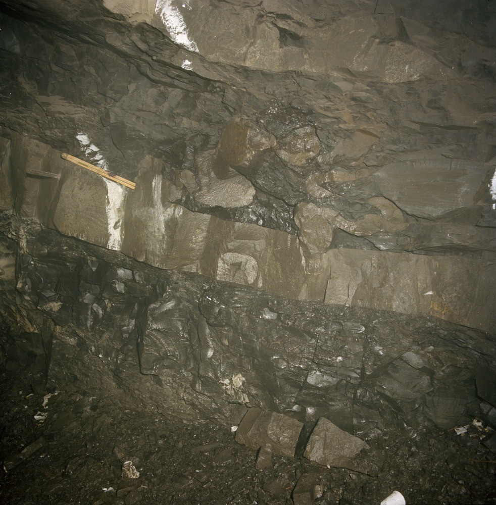
| Caption: | Wyresdale Tunnel (Lune-Wyre Link) SE of Lancaster, 1550 m. from the Abbeystead Portal. |
| Description: | Wyresdale Tunnel (Lune-Wyre Link) SE of Lancaster, 1550 m. from the Abbeystead Portal. Sandstone with convoluted top. Penecontemporaneous slumping has disturbed the upper part of a 0.5 m. turbiditic sandstone (centre of photograph). The disturbed top of the sandstone has been plastically deformed and contains numerous mudstone lithoclasts. It can be traced from the right of the scale, pinching and swelling as it extends upwards into the overlying silty mudstone. Scale = 0.5 m. |
| Date taken: | Thu Feb 02 00:00:00 GMT 1978 |
| Photographer: | Thornton, K.E. |
| Copyright statement: | NERC |
| X longitude/easting: | 355210 |
| Y latitude/northing: | 455410 |
| Coordinate reference system, ESPG code: | 27700 (OSGB 1936 / British National Grid) |
| Orientation: | Portrait |
| Size: | 291.88 KB; 982 x 1000 pixels; 83 x 85 mm (print at 300 DPI); 260 x 265 mm (screen at 96 DPI); |
| Average Rating: | Not yet rated |
| Categories: | Unsorted Images |
Loading...
Loading...
Reviews
There is currently no feedback