| P number: | P222511 |
|---|---|
| Old photograph number: | L01708 |
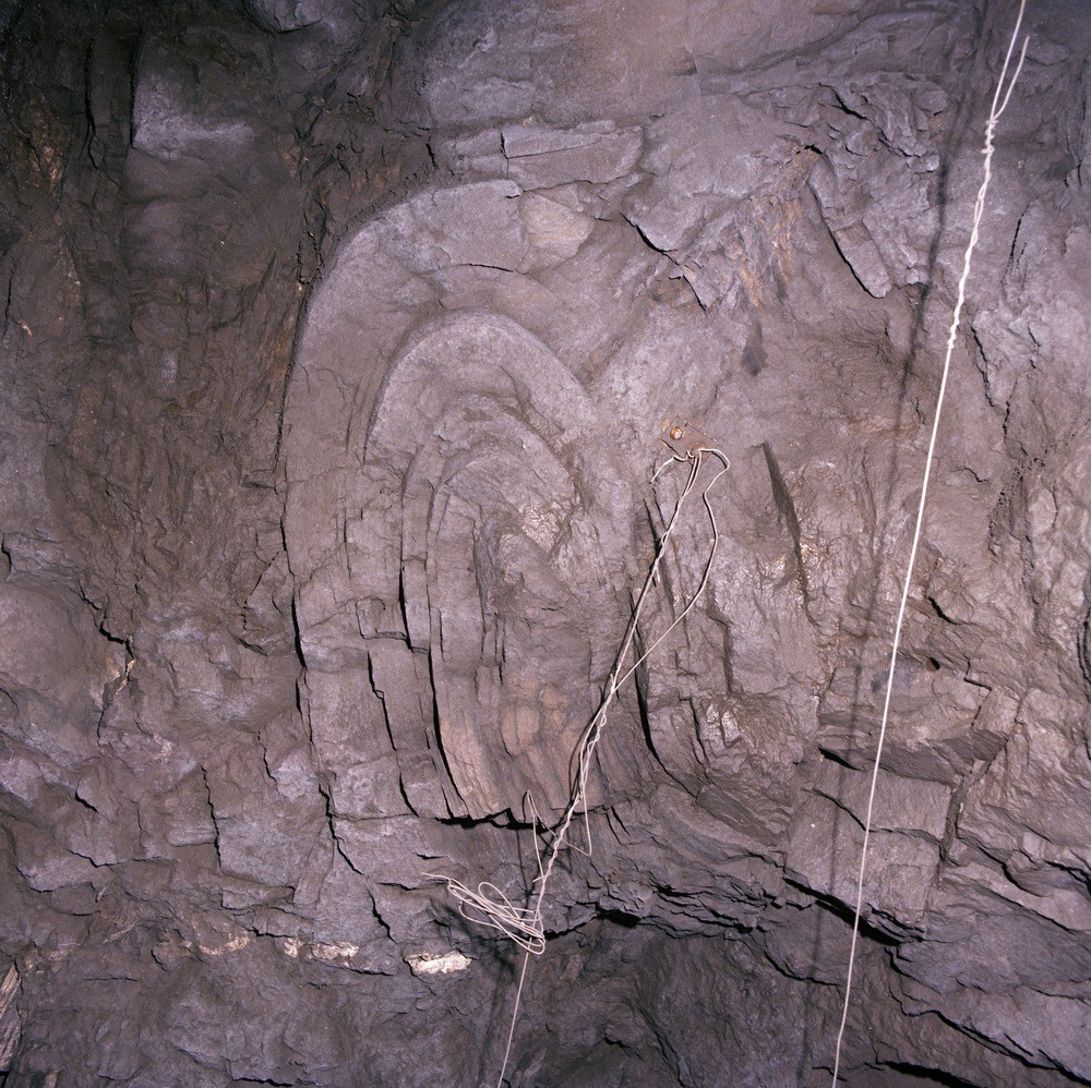
| Caption: | Wyresdale Tunnel (Lune-Wyre Link) SE of Lancaster, 700 m. from the Rowton Portal. |
| Description: | Wyresdale Tunnel (Lune-Wyre Link) SE of Lancaster, 700 m. from the Rowton Portal. Intraformational slump in interbedded striped siltstones and sandstones. The penecontemporaneous slump occurs in a 2 m. unit of distorted strata that is contained within a northerly-dipping sequence of interbedded striped siltstones and thin sandstones. The slump is approximately 1 m. across (measured normal to axial plane) and is seen in the roof of the tunnel. The movement indicated by the slump is from north-west to south-east. |
| Date taken: | Thu Feb 02 00:00:00 GMT 1978 |
| Photographer: | Thornton, K.E. |
| Copyright statement: | NERC |
| X longitude/easting: | 352890 |
| Y latitude/northing: | 459080 |
| Coordinate reference system, ESPG code: | 27700 (OSGB 1936 / British National Grid) |
| Orientation: | Landscape |
| Size: | 365.43 KB; 1000 x 998 pixels; 85 x 84 mm (print at 300 DPI); 265 x 264 mm (screen at 96 DPI); |
| Average Rating: | Not yet rated |
| Categories: | Unsorted Images, Geoscience subjects/ Sedimentary features/ Slumping |
Loading...
Loading...
Reviews
There is currently no feedback