| P number: | P222472 |
|---|---|
| Old photograph number: | L01662 |
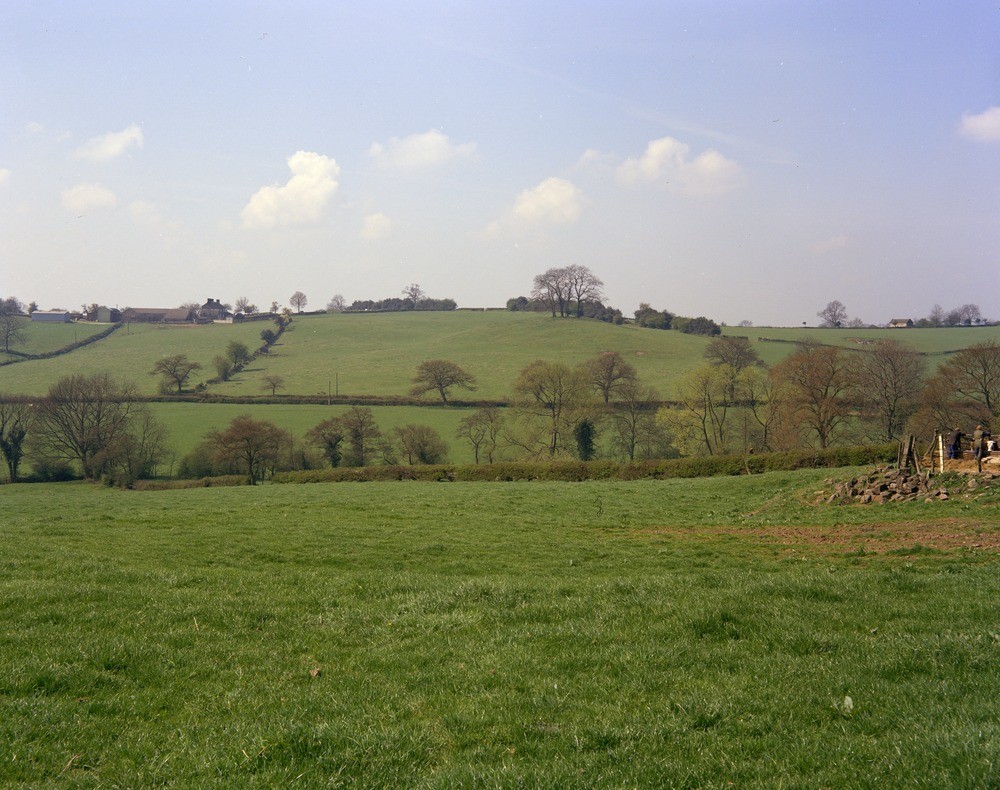
| Caption: | Small hill, 800 m. ESE of Hollington. Looking WSW. |
| Description: | Small hill, 800 m. ESE of Hollington. Looking WSW. Drift features overlying 'Keuper Marl'. View across a valley to a small ridge and knoll (in centre with small coppice) formed by glacial sand and gravel overlying mudstones and siltstones of the 'Keuper Marl' formation (Triassic). The subdued nature of the feature should be noted and the fact that it is elevated both from the 'solid' of the ridge to the left of the farm, and from the till capping the ridge to the right (where a single house can be seen). The implication of these aspects imply that sand and gravel deposition post-dated deposition of the till but is not 'fresh' enough to be part of the last glaciation (Devensian). It is thus thought to belong to the same glacial event as the till (pre-Ipswichian ? Anglian or Wolstonian). |
| Date taken: | Wed Sep 01 00:00:00 BST 1976 |
| Photographer: | Thornton, K.E. |
| Copyright statement: | NERC |
| X longitude/easting: | 406800 |
| Y latitude/northing: | 338700 |
| Coordinate reference system, ESPG code: | 27700 (OSGB 1936 / British National Grid) |
| Orientation: | Landscape |
| Size: | 230.83 KB; 1000 x 790 pixels; 85 x 67 mm (print at 300 DPI); 265 x 209 mm (screen at 96 DPI); |
| Average Rating: | Not yet rated |
| Categories: | Unsorted Images |
Loading...
Loading...
Reviews
There is currently no feedback