| P number: | P222372 |
|---|---|
| Old photograph number: | L01556 |
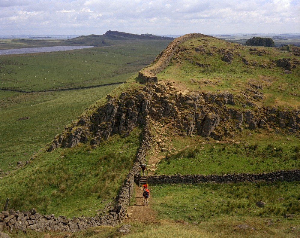
| Caption: | N. end of Cuddy Crags from Hotbank Crags, Roman Wall. Looking E. |
| Description: | N. end of Cuddy Crags from Hotbank Crags, Roman Wall. Looking E. Vertical columnar jointing in the Whin Sill. Scarp cut by drainage channel in foreground. Broomlee Lough in top left overlooked by Sewingshields Crags (Whin) and smaller sandstone crags (Dove Crags). |
| Date taken: | Mon Jul 01 00:00:00 BST 1974 |
| Photographer: | Thornton, K.E. |
| Copyright statement: | NERC |
| X longitude/easting: | 378110 |
| Y latitude/northing: | 568650 |
| Coordinate reference system, ESPG code: | 27700 (OSGB 1936 / British National Grid) |
| Orientation: | Landscape |
| Size: | 292.28 KB; 1000 x 792 pixels; 85 x 67 mm (print at 300 DPI); 265 x 210 mm (screen at 96 DPI); |
| Average Rating: | Not yet rated |
| Categories: | Unsorted Images, Geoscience subjects/ Igneous features/ Sills |
Loading...
Loading...
Reviews
There is currently no feedback