| P number: | P222329 |
|---|---|
| Old photograph number: | L01512 |
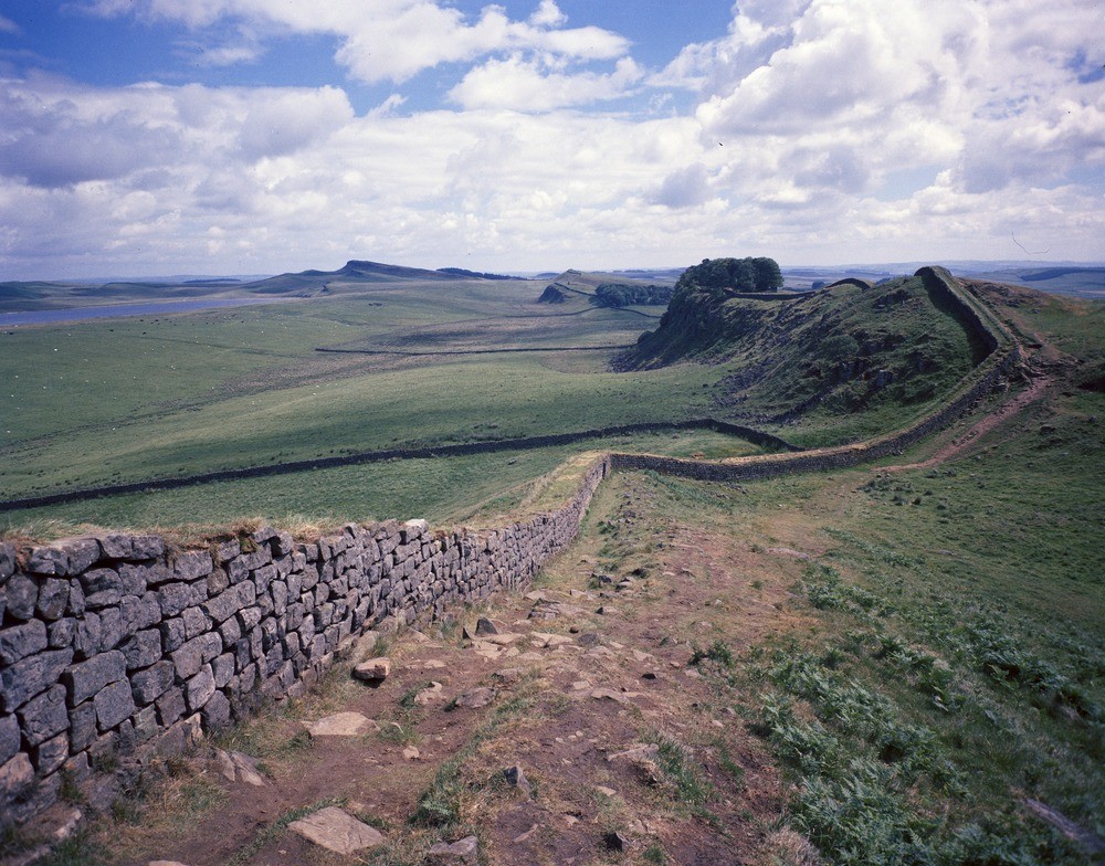
| Caption: | Housesteads Crags from Cuddy Crags. |
| Description: | Housesteads Crags from Cuddy Crags. Scarp and dip-slopes of the Whin Sill protruding through elongate ridges of boulder clay. Sewingshields Crags on horizon in centre just over 1000 ft. Broomlee Lough to the left. Roman Wall capping the Whin crags. |
| Date taken: | Mon Jul 01 00:00:00 BST 1974 |
| Photographer: | Thornton, K.E. |
| Copyright statement: | NERC |
| X longitude/easting: | 378300 |
| Y latitude/northing: | 568700 |
| Coordinate reference system, ESPG code: | 27700 (OSGB 1936 / British National Grid) |
| Orientation: | Landscape |
| Size: | 307.67 KB; 1000 x 784 pixels; 85 x 66 mm (print at 300 DPI); 265 x 207 mm (screen at 96 DPI); |
| Average Rating: | Not yet rated |
| Categories: | Best of BGS Images/ Landscapes, Geoscience subjects/ Igneous features/ Sills |
Loading...
Loading...
Reviews
There is currently no feedback