| P number: | P220500 |
|---|---|
| Old photograph number: | D04538 |
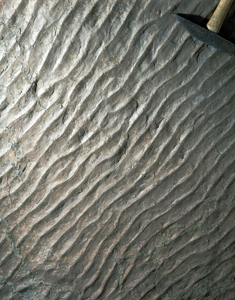
| Caption: | Ripple marks, Quarry Hill, Rhynie, Aberdeenshire. |
| Description: | Ripple markings on the underside of a loose block in the quarry spoil. The rock was found in a disused quarry on Quarry Hill, Rhynie in the Devonian Quarry Hill Sandstone Formation, a sequence of pale pink to grey massive sandstone with thin siltstone beds. The ripple marks are undulating subparallel small-scale ridges and hollows caused by the action of a fluid, in this case water, on an unconsolidated sediment, the sand. The structure over time has been preserved when the sediment underwent diagenesis to a rock. The Lower Old Red Sandstone rocks in the Rhynie outlier were laid down as early sheet-flood conglomerates succeeded by braided stream deposits directed northwards and later by floodplain sediments. |
| Date taken: | Fri Jun 01 00:00:00 BST 1990 |
| Photographer: | McTaggart, F.I. |
| Copyright statement: | NERC |
| X longitude/easting: | 348600 |
| Y latitude/northing: | 825400 |
| Coordinate reference system, ESPG code: | 27700 (OSGB 1936 / British National Grid) |
| Orientation: | Portrait |
| Size: | 613.79 KB; 785 x 1000 pixels; 66 x 85 mm (print at 300 DPI); 208 x 265 mm (screen at 96 DPI); |
| Average Rating: | Not yet rated |
| Categories: | Best of BGS Images/ Geological structures |
Loading...
Loading...
Reviews
There is currently no feedback